Counting the waves…
Counting the waves…
A refined fusion of water purity, environmental stability, and communal vibrancy for Playa Banco Cabo Vírgenes.
View MethodologyAnalyzed via live sensors and environmental data.
Wave height, wind, and atmospheric stability.
Live footfall and crowd balance metrics.
Community reviews and curated sentiment.
“You arrive at high tide to find only narrow pebble strips. Return six hours later and vast sand shelves extend two hundred meters toward the channel, exposing marine architecture normally hidden below waves.”
Limited recent visitor reports — live OBI telemetry is your best guide for current conditions.
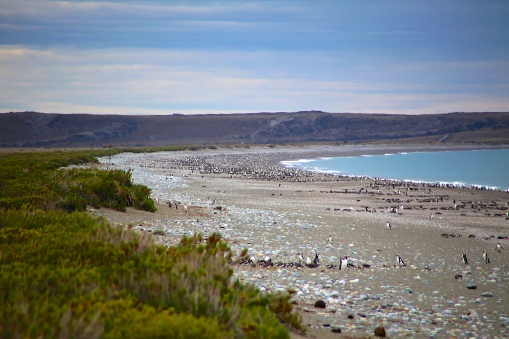
Playa Banco Cabo Vírgenes operates on the strait's dramatic tidal range, which can exceed seven meters during spring tides. What appears as a modest pebble shore at high water transforms into an expansive tidal flat system at low, revealing sand banks, gravel bars, and the skeletal remains of kelp holdfasts ripped from offshore reefs. You time your visit for the falling tide and watch the ocean retreat, leaving behind pools that reflect sky and scudding clouds.
The exposed sand is firm enough to walk on without sinking, compressed by the weight of twice-daily inundation. You venture outward, following channels carved by the draining tide, discovering anemones clinging to isolated rocks and crabs skittering sideways into crevices. Offshore, the shipping channel that funnels vessels between oceans looks deceptively calm from this angle, though you know the currents there run strong enough to tear anchors from bottom. A freighter passes northbound, heading for the Pacific, so distant it appears motionless.
 Credit: Unsplash
aerial view of city buildings near body of water during daytime
 Credit: Unsplash
a large rock sitting on top of a beach next to the ocean
Capture exposed banco sand reflections
Search revealed pools for marine life
Document sky doubled in wet sand
Prime Visitation
Anytime | Less Crowds
Where it is
Playa Banco Cabo Vírgenes
Cabo Vírgenes, Santa Cruz, Argentina
-52.366800°, -68.402600°
Weather
Loading…
Swell
—
Temp
Warm · Restorative
UV Index
Moderate
Wind
—
Tidal State
Last known
Max Sunlight
—
Ideal Shade
—
Jan - Dec (Peak)
Mar - Nov (Off-season)
Anytime | Less Crowds
Select a category to load nearby places.
Unlock restaurants, luxury stays and curated maritime experiences within 2km
Swimming is not advisable at Playa Banco due to frigid water temperatures, strong tidal currents, and its location near the Magellan Strait entrance, where Atlantic and Pacific waters meet. The tidal nature of this beach means conditions change rapidly, with expansive flats during low tide and powerful water movement during tide changes. The beach is better suited for tidal pool exploration, beachcombing, and photography. Always maintain awareness of tide times to avoid being caught by incoming water. The remote location and lack of lifeguards or emergency services make water activities particularly risky.
Visit during the austral summer (December to February) for the most comfortable conditions, though the beach remains accessible year-round for hardy travelers. Evening visits during summer months offer spectacular sunset opportunities over the Strait of Magellan. Check tide schedules before visiting, as low tide reveals extensive beach areas and tidal formations. Spring (October-November) and autumn (March-April) see fewer visitors while maintaining reasonable weather. Wind is constant across all seasons, so come prepared with appropriate clothing. The lack of crowds at any time makes flexible scheduling possible.
Access requires driving to Cabo Vírgenes from Río Gallegos, approximately 130 kilometers south via Route 1, a journey of 2-3 hours largely on gravel roads. From the main Cabo Vírgenes lighthouse area, reaching Playa Banco involves walking or driving (if conditions permit) toward the tidal beach sectors. Local knowledge or GPS coordinates help locate this specific beach section. Rental vehicles from Río Gallegos provide the most flexibility; some travelers join organized tours but these typically focus on the lighthouse and penguin reserve. Plan for self-navigation in this remote coastal environment.
No food services or accommodation exist at or near this beach. Río Gallegos, approximately 130 kilometers north, serves as the base for visitors, offering hotels ranging from budget to mid-range, restaurants serving Patagonian cuisine, and supermarkets for supplies. Pack all food, drinking water, and emergency provisions before departing Río Gallegos. The journey requires sufficient fuel for a round trip, as no gas stations exist en route. Some travelers stay at rural estancias in the region, but these require advance reservation and still necessitate bringing supplies for beach visits.
Playa Banco's tidal character sets it apart, revealing vast beach expanses and formations during low tide that disappear as waters rise. Its position near the Magellan Strait entrance offers unique geographical significance, where two oceans effectively meet. The calm conditions mentioned refer to sheltered periods between tidal movements, creating brief windows of tranquility. Unlike the rockier northern and southern beaches, this sector offers different coastal morphology. Few travelers venture to this specific section, ensuring solitude and pristine conditions. The sunsets over the strait create memorable photographic opportunities distinct from Atlantic-facing beaches.
Photos