Counting the waves…
Counting the waves…
A refined fusion of water purity, environmental stability, and communal vibrancy for Wreck Beach.
View MethodologyAnalyzed via live sensors and environmental data.
Wave height, wind, and atmospheric stability.
Live footfall and crowd balance metrics.
Community reviews and curated sentiment.
“You'll walk right past the turnoff if you're not watching for it—a narrow track between coastal scrub that drops you onto blonde sand cupped by wooded bluffs. The water here laps rather than crashes, and the only…”
Limited recent visitor reports — live OBI telemetry is your best guide for current conditions.
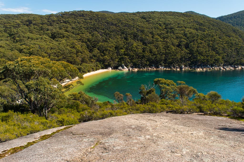
Wreck Beach sits in the shadow of its famous neighbors, a quiet crescent tucked into the Tomaree coastline that most visitors speed past en route to Zenith or Shoal Bay. The approach is half the charm: a short, unmarked trail through banksias and coastal heath that opens suddenly onto a sweep of fine sand bordered by rock platforms and low sandstone cliffs. The beach faces northeast, sheltered enough that the water stays calm even when southerlies churn the outer beaches.
The rock shelf at the southern end reveals a mosaic of tidal pools at low tide—anemones the color of wine, tiny darting fish, and brittle stars clinging to algae-slicked stone. Snorkelers work the deeper water along the rocks, where kingfish and luderick drift in the kelp shadows. By mid-afternoon, sunlight slants through the Norfolk pines fringing the headland, casting long shadows across sand that holds warmth well into evening.
Crashing wave at sunset on the shoreline
Long-tail boats moored in clear water
Sheltered cove, minimal swell
Southern end at high tide
Norfolk pines frame the arc
Where it is
Wreck Beach
Port Stephens, New South Wales, Australia
-32.706800°, 152.158500°
Weather
Loading…
Swell
—
Temp
Warm · Restorative
UV Index
Moderate
Wind
—
Tidal State
Last known
Max Sunlight
—
Ideal Shade
—
Jan - Dec (Peak)
Mar - Nov (Off-season)
Historical data suggests peak visibility and stable sea temperatures occur during the prime visitation window.
Select a category to load nearby places.
Unlock restaurants, luxury stays and curated maritime experiences within 2km
Wreck Beach is generally calm and sheltered, making it suitable for swimming in most conditions. The beach sits within Tomaree National Park and is protected from strong ocean swells. However, it's an unpatrolled beach with no lifeguards on duty, so swimmers should exercise caution and assess conditions before entering the water. Check local surf reports and be aware of changing tides. It's best suited for confident swimmers, and children should be supervised at all times. The gentle conditions typically make it safer than some of Port Stephens' more exposed ocean beaches.
Wreck Beach can be enjoyed year-round thanks to Port Stephens' temperate coastal climate. Summer (December-February) offers warm water and beach weather, though weekends can be busier. Autumn and spring provide pleasant temperatures with fewer crowds, ideal for peaceful visits. Winter remains mild, with average temperatures around 17-19°C, perfect for beach walks and whale watching from nearby headlands (June-November). Early morning visits offer the most tranquility regardless of season. The beach's sheltered position means it's often comfortable even on breezy days when more exposed beaches feel too windy.
Wreck Beach requires a short walk to reach, contributing to its quieter atmosphere. Access is via the Tomaree Coastal Walk from either Shoal Bay or Zenith Beach. From Shoal Bay, park at the public car park on Shoal Bay Road and follow the coastal trail approximately 20-30 minutes south. Alternatively, park at Zenith Beach car park and walk north along the track. Both routes involve some stairs and uneven terrain. There's no direct vehicle access or dedicated parking at Wreck Beach itself, so wear comfortable walking shoes and bring everything you need for your beach visit.
Wreck Beach has no facilities, so visitors must be self-sufficient. Bring your own food, water, and sun protection, and take all rubbish with you. The nearest amenities are at Shoal Bay or Zenith Beach, each about a 20-30 minute walk away, where you'll find cafes, restrooms, and shops. Shoal Bay offers more dining options and convenience stores. For accommodation, both Shoal Bay and nearby Shoal Bay village provide hotels, holiday apartments, and camping options. Nelson Bay, the main town in Port Stephens (10 minutes' drive), has extensive accommodation, restaurants, and supermarkets for stocking up before your beach walk.
Wreck Beach derives its name from the SS Sygna, a Norwegian ship that ran aground during a severe storm in 1974. However, the wreck itself is not at Wreck Beach—it's located on Stockton Beach near Newcastle, south of Port Stephens. The naming likely reflects the area's maritime history and the dramatic coastline that has challenged vessels over the years. Despite the name's origin story, Wreck Beach today is known for its pristine beauty and relative seclusion rather than visible shipwrecks. The beach remains a hidden gem within Tomaree National Park, offering stunning natural scenery and peaceful surroundings.
Photos