Counting the waves…
Counting the waves…
A refined fusion of water purity, environmental stability, and communal vibrancy for Anabranch.
View MethodologyAnalyzed via live sensors and environmental data.
Wave height, wind, and atmospheric stability.
Live footfall and crowd balance metrics.
Community reviews and curated sentiment.
“You park on cracked earth between old fishermen's shacks and walk toward a shoreline shaped entirely by the Burdekin River's moods. Sand flats stretch wide at low tide, the air thick with salt and mangrove tang. This is…”
Limited recent visitor reports — live OBI telemetry is your best guide for current conditions.
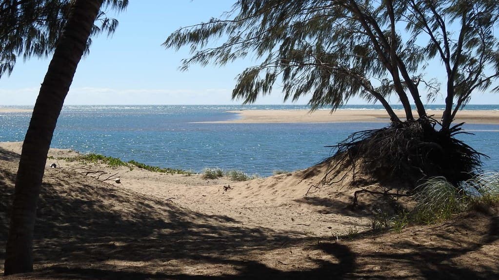
Anabranch sits where the Burdekin River's distributary channels weave through sand and wetland before losing themselves in the ocean, a geographic quirk that leaves this beach feeling neither estuary nor open sea but something liminal and alive. You reach it along unsealed tracks through cane fields near Jarvisfield, past corrugated-iron shacks that have witnessed decades of fishing runs, cyclone warnings, and the slow, patient rhythms of delta life. The sand is broad and firm, rippled by retreating tides that expose oyster beds and wader birds picking their way through shallows.
This is not a beach for postcard fantasies. The water runs murky with sediment from upstream, the colour of milky tea stirred with silt from the Herbert and Burdekin catchments. Yet that turbidity carries richness—bream, flathead, barramundi move through the shallows, and locals arrive before dawn with rods and tackle boxes, reading the tide charts like scripture. The shacks, some little more than raised timber platforms with sun-bleached walls, speak to a different era of coastal access, before resorts and development plans.
Credit: PexelsTidal Flats Wading
Low tide exposes vast sandbars
Document weathered timber fishing huts
Bream and flathead at dawn
Where it is
Anabranch
Jarvisfield, Queensland, Australia
-19.555660°, 147.560440°
Weather
Loading…
Swell
—
Temp
Warm · Restorative
UV Index
Moderate
Wind
—
Tidal State
Last known
Max Sunlight
—
Ideal Shade
—
May - Sep (Peak)
Jan - Dec (Off-season)
Historical data suggests peak visibility and stable sea temperatures occur during the prime visitation window.
Select a category to load nearby places.
Unlock restaurants, luxury stays and curated maritime experiences within 2km
Swimming conditions at Anabranch Beach vary with tides and currents due to its location near the Burdekin River delta. The beach is unpatrolled, so swimmers should exercise caution and stay alert to changing conditions. River outflow can create stronger currents, particularly after rainfall. The remote nature means no lifeguard services are available. Check local tide charts before entering the water, avoid swimming alone, and be mindful that marine stingers may be present in warmer months (November-May), when protective clothing is recommended.
Anabranch Beach is accessible year-round, with each season offering different experiences. Winter months (May-September) provide comfortable temperatures, clear skies, and lower humidity, ideal for beach walks and exploration. Summer brings warmer water temperatures but also tropical heat, humidity, and potential wet season storms (December-March). The shoulder seasons of April-May and September-October often deliver pleasant weather with fewer crowds. Early mornings generally offer calmer conditions and better opportunities to experience the beach's tranquil, remote atmosphere regardless of season.
Anabranch Beach is located near Jarvisfield, approximately 90 kilometres north of Townsville in North Queensland. Access typically requires a vehicle, as public transport options are limited in this rural area. The beach is reached via local roads off the Bruce Highway; a standard vehicle can usually access the area in dry conditions, though wet weather may affect track conditions. Parking is informal and limited to cleared areas near the beach access points. Check locally for current road conditions before travelling, especially during the wet season.
Anabranch Beach is a remote, undeveloped location with no commercial facilities directly on site. Visitors should bring all necessary supplies, including food, water, and sun protection. The nearest services are in the Ayr-Home Hill area, roughly 20-30 minutes away, where you'll find supermarkets, cafes, and fuel stations. Accommodation options include motels and caravan parks in Ayr or Home Hill rather than beachfront properties. This is very much a bring-your-own-everything destination, so plan accordingly and take all rubbish with you when leaving.
Anabranch Beach has a distinctive heritage of traditional fishing shacks that reflects Queensland's coastal culture from earlier decades. These simple, often rustic structures were built by locals seeking weekend and holiday retreats along this remote Burdekin delta coastline. While the shack culture has diminished over time due to regulations and coastal management policies, remnants of this history contribute to the beach's authentic, uncommercialised character. The area retains a sense of old Queensland coastal life, offering a contrast to developed tourist beaches and attracting visitors interested in genuine regional heritage.
Photos