
Counting the waves…
Counting the waves…
A refined fusion of water purity, environmental stability, and communal vibrancy for North Point Beach.
View MethodologyAnalyzed via live sensors and environmental data.
Wave height, wind, and atmospheric stability.
Live footfall and crowd balance metrics.
Community reviews and curated sentiment.
“You'll feel the shift the moment your 4WD crests the final dune: easterly swells hammer the shore in rhythmic sets, salt hangs thick in the air, and stretches of untouched sand run toward Cape Moreton lighthouse. The…”
Limited recent visitor reports — live OBI telemetry is your best guide for current conditions.
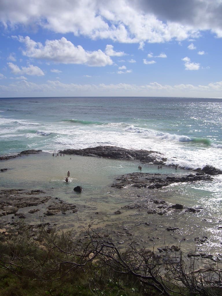
North Point Beach occupies the wild northeastern shoulder of Moreton Island, where the Coral Sea throws its full weight against a coastline unmarred by development. The sand here is pale, almost blinding under midday sun, and the shore curves gently for kilometers with nothing but dunes, pandanus scrub, and the occasional sea eagle overhead. Waves fold and collapse in powerful, glassy lines when conditions align, and you'll spend long minutes watching the horizon before spotting another soul.
Reaching this edge of the island demands commitment: you'll navigate soft sand tracks by four-wheel-drive, crossing the island's spine from the protected western beach. The journey filters out day-trippers, leaving the beach to serious surfers, campers who've hauled their gear across the island, and those willing to trade convenience for solitude. There's no cafe, no lifeguard tower, no cell signal—just you, the ocean, and the occasional pod of dolphins cutting through the break.
Credit: FlickrRide Offshore Breaks
Powerful swells, uncrowded line-up
Cape Moreton backdrop at dawn
Wildflower trails behind beach
Where it is
North Point Beach
Moreton Island, Queensland, Australia
-27.031100°, 153.382500°
Weather
Loading…
Swell
—
Temp
Warm · Restorative
UV Index
Moderate
Wind
—
Tidal State
Last known
Max Sunlight
—
Ideal Shade
—
Jan - Dec (Peak)
Mar - Nov (Off-season)
Historical data suggests peak visibility and stable sea temperatures occur during the prime visitation window.
Select a category to load nearby places.
Unlock restaurants, luxury stays and curated maritime experiences within 2km
North Point Beach faces the open ocean and typically experiences strong currents, powerful surf, and occasional rips, making swimming conditions challenging and potentially dangerous. The beach is unpatrolled with no lifeguard services. Many visitors choose to wade in shallow water rather than swim. If you do enter the water, never swim alone, stay close to shore, and be extremely cautious of changing conditions. The beach is better suited for experienced ocean swimmers. Always check conditions before entering and avoid swimming during rough weather or high winds.
North Point Beach can be visited year-round, with each season offering different experiences. June to October (winter/spring) typically brings calmer seas, clearer skies, and excellent whale watching opportunities as humpback whales migrate past the point. Summer (December to February) offers warm weather ideal for beach activities, though occasional storms and jellyfish may be present. Autumn (March to May) provides pleasant temperatures with fewer crowds. Early mornings generally offer the calmest conditions and best light for photography. Always check weather forecasts and tide times before visiting this remote location.
North Point Beach is accessible only by 4WD vehicle along Moreton Island's beach tracks or by organized tour. You must first reach Moreton Island via passenger ferry or vehicle barge from the mainland (Tangalooma, Kooringal, or Amity Point). The drive from main arrival points takes 1-2 hours through sand tracks requiring 4WD experience and appropriate permits. There's no formal parking area—vehicles park on designated beach access points above the high-tide line. Lowering tire pressure is essential, and travel is tide-dependent. Many visitors join guided tours instead of self-driving.
North Point Beach is extremely remote with no facilities, food vendors, or amenities whatsoever. Visitors must bring all supplies including water, food, and emergency equipment. The nearest accommodation options are at Tangalooma Island Resort (about 2 hours' drive south) or camping areas at Ben-Ewa, Comboyuro Point, or Blue Lagoon, which require camping permits. Basic facilities exist only at these camping zones. Mobile phone coverage is unreliable. Given the isolation, thorough preparation is essential—pack out all rubbish and bring sufficient fuel, as there are no services available on this part of the island.
Yes, North Point is one of Queensland's premier land-based whale watching locations. Between June and October, humpback whales migrate along the coast, often passing very close to North Point as they round the island's northern tip. The elevated headland provides excellent vantage points for spotting whales breaching, tail-slapping, and nurturing calves. September typically sees peak numbers during the southern migration. Bring binoculars for the best experience, though whales are often visible to the naked eye. The point's geography funnels whales close to shore, making it genuinely spectacular for whale watching without requiring a boat tour.
Photos