Counting the waves…
Counting the waves…
A refined fusion of water purity, environmental stability, and communal vibrancy for Lighthouse Bay.
View MethodologyAnalyzed via live sensors and environmental data.
Wave height, wind, and atmospheric stability.
Live footfall and crowd balance metrics.
Community reviews and curated sentiment.
“You'll descend a rough track to find this windswept cove beneath Cape Bruny Lighthouse, where southern right whales breach offshore and the only footprints in the sand might be yours. The salt spray carries the scent of…”
Limited recent visitor reports — live OBI telemetry is your best guide for current conditions.
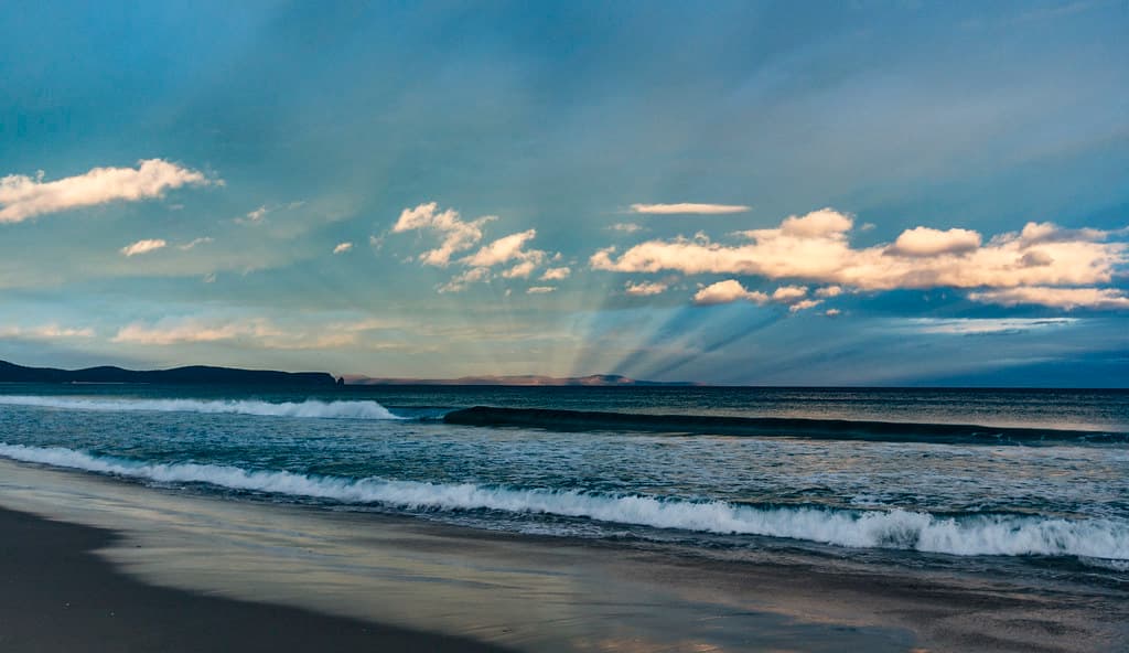
The track from South Bruny National Park drops you onto a scallop of sand tucked beneath the cliffs, where the 1838 lighthouse stands white against the sky. Waves roll in from the Southern Ocean with nothing between you and Antarctica but open water, their rhythm broken only by the occasional seal hauling out on offshore rocks. The beach curves into protected pockets where driftwood tangles with Neptune's necklace seaweed, and if you time it right during whale season—June through September—you'll watch flukes rise and fall beyond the breakers.
This is not a swimming beach; the rip is unforgiving and the water hovers around twelve degrees even in summer. Instead, you'll walk the tide line collecting cuttlebones and blue-ringed argonaut shells, or scramble over the dolerite platforms at low tide where starfish cling in tidal pools. The wind rarely stops, carrying with it the cries of Pacific gulls and the distant pulse of the lighthouse foghorn.
 Credit: Unsplash
a group of birds standing on top of a sandy beach
 Credit: Unsplash
a person sitting on a rock near the ocean
Lighthouse trail above crashing swells
Southern rights breach June to September
Bruny Island shacks en route
Where it is
Lighthouse Bay
Bruny Island, Tasmania, Australia
-43.391400°, 147.321400°
Weather
Loading…
Swell
—
Temp
Warm · Restorative
UV Index
Moderate
Wind
—
Tidal State
Last known
Max Sunlight
—
Ideal Shade
—
Jan - Dec (Peak)
Mar - Nov (Off-season)
Historical data suggests peak visibility and stable sea temperatures occur during the prime visitation window.
Select a category to load nearby places.
Unlock restaurants, luxury stays and curated maritime experiences within 2km
Swimming conditions at Lighthouse Bay can be challenging due to strong currents, ocean swells, and cooler Southern Ocean waters. The beach is relatively exposed and lacks patrolled swimming areas or lifeguards. Most visitors come for the scenery and lighthouse views rather than swimming. If you do enter the water, stay close to shore, never swim alone, and be extremely cautious of changing conditions. The remote location means emergency services are far away, so prioritize safety and consider this primarily a beach for walking and sightseeing.
Lighthouse Bay can be visited year-round, though each season offers different experiences. Summer (December-February) provides the warmest weather and longest daylight hours, ideal for extended exploration. Winter (June-August) brings dramatic seas and potential whale watching opportunities, though expect colder, windier conditions. Spring and autumn offer mild temperatures and fewer crowds. For the best lighthouse photography, consider visiting during golden hour at sunrise or sunset. Weather on Bruny Island changes quickly, so bring layers regardless of season and check conditions before making the drive to this remote location.
Reaching Lighthouse Bay requires taking the vehicle ferry from Kettering to Bruny Island (approximately 20-minute crossing), then driving south through the island. The journey involves mostly sealed roads, though some sections may be gravel. You'll need to reach the Cape Bruny Lighthouse area at the island's southern tip. Parking is available near the lighthouse reserve. The remote location means limited mobile phone coverage, so download maps beforehand. Allow approximately 90 minutes total driving from the ferry terminal. A standard vehicle is suitable, though conditions can be challenging in poor weather.
Lighthouse Bay is extremely remote with no facilities, food vendors, or amenities directly at the beach. The nearest services are in Adventure Bay or Alonnah, approximately 30-45 minutes' drive north, where you'll find cafes, restaurants, and general stores. Accommodation options on Bruny Island include holiday rentals, B&Bs, and camping facilities, primarily concentrated in the northern and central areas. There are no toilets or shelters at Lighthouse Bay itself, so come fully prepared with water, food, and appropriate clothing. Plan ahead and bring everything you need for your visit.
Yes, Cape Bruny Lighthouse offers guided tours, typically running daily during peak seasons and on weekends during quieter periods. The lighthouse, built in 1838, is Tasmania's second-oldest and provides spectacular 360-degree views from the top. Tours include climbing the tower and learning about the area's maritime history. Booking ahead is recommended, especially during summer holidays. The lighthouse grounds are accessible even when tours aren't operating, allowing visitors to explore the area and enjoy views of Lighthouse Bay below. Check current tour schedules and availability before your visit, as times can vary seasonally.
Photos