
Counting the waves…
Counting the waves…
A refined fusion of water purity, environmental stability, and communal vibrancy for Playa Tamales.
View MethodologyAnalyzed via live sensors and environmental data.
Wave height, wind, and atmospheric stability.
Live footfall and crowd balance metrics.
Community reviews and curated sentiment.
“At the terminus of civilization—where the coastal track dissolves into footpaths and rivers—this off-grid strand collects driftwood, surf, and the kind of silence that makes you recalibrate what 'remote' actually means.”
Limited recent visitor reports — live OBI telemetry is your best guide for current conditions.
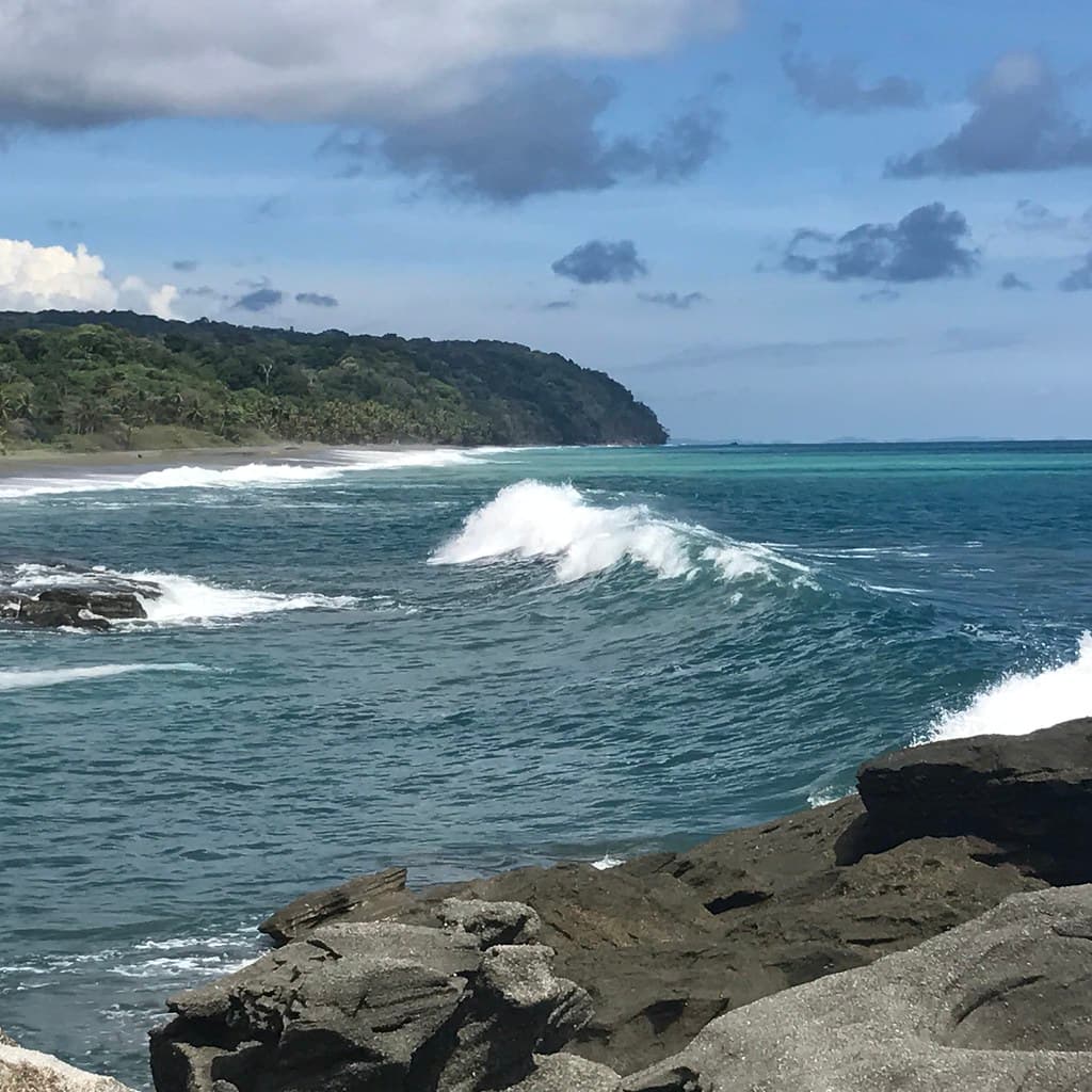
Carate marks the end of the line. Beyond the small landing strip and handful of eco-lodges, vehicular ambition yields to trails that penetrate Corcovado National Park. Playa Tamales stretches north from this threshold, a length of charcoal-grey sand pounded by swells that have crossed the Pacific uninterrupted. The beach runs wide at low tide, narrowing to a ribbon when high water pushes against the palm groves and dense coastal scrub. Driftwood logs—bleached silver by sun and salt—lie scattered like the bones of ancient vessels.
You'll walk this beach alone more often than not, scanning the wrack line for the prints of jaguars, tapirs, or the distinctive three-toed scratch of a scarlet macaw. Offshore, humpback whales breach between July and October, their exhalations audible even over the surf's constant rumble. The sunsets pour molten copper across the horizon, silhouetting the Osa's mountainous spine and turning the wet sand into a mirror that reflects every gradient from amber to violet.
Long-tail boats moored in clear water
Crystal lagoon with rocky outcrop
Gateway to Corcovado trails
Driftwood sculptures, whale spouts offshore
Powerful waves, experienced swimmers only
Prime Visitation
Best Weather|Less Crowds
Where it is
Playa Tamales
Carate, Puntarenas, Costa Rica
8.365700°, -83.347600°
Weather
Loading…
Swell
—
Temp
Warm · Restorative
UV Index
Moderate
Wind
—
Tidal State
Last known
Max Sunlight
—
Ideal Shade
—
Jan - Dec (Peak)
May - Nov (Off-season)
Best Weather|Less Crowds
Select a category to load nearby places.
Unlock restaurants, luxury stays and curated maritime experiences within 2km
Swimming at Playa Tamales requires caution due to typical Pacific coast conditions including strong currents, waves, and potential rip tides. This remote beach has no lifeguards or safety services. The beach is exposed to open ocean swells that can be powerful and unpredictable. Wildlife considerations include watching for crocodiles near any freshwater outlets. Most visitors enjoy wading and beachcombing rather than swimming. If you do enter the water, stay in shallow areas, never swim alone, and assess conditions carefully first.
The dry season from December through April offers the best weather with consistent sunshine and more manageable ocean conditions. February and March provide excellent conditions with fewer crowds than holiday periods. The wet season (May-November) brings afternoon rains and rougher seas but also lush landscapes and potential wildlife sightings. September and October are wettest with challenging access roads. Early mornings year-round offer the calmest conditions and best wildlife viewing opportunities. Sunsets are spectacular throughout the year at this west-facing beach.
Access Playa Tamales by first reaching Carate from Puerto Jiménez—approximately 2 hours by 4WD vehicle or collective taxi on a rough, sometimes challenging road (impassable in heavy rain). From Carate, Playa Tamales is a short distance along the coast toward Cabo Matapalo, accessible by walking along the beach or coastal paths. The area lacks clear signage, so asking locals in Carate for directions is helpful. Some visitors arrange boat access from Puerto Jiménez. The remote location requires planning and flexibility.
Playa Tamales has no direct development. Carate, nearby, offers a few very rustic eco-lodges and basic camping options with minimal amenities. These typically require advance booking and include meals, as no restaurants or stores exist in the immediate area. Most visitors exploring this beach stay in Puerto Jiménez and visit as a day trip, or they're trekking to/from Corcovado. Bring all necessary food, water, and supplies. The area is genuinely off-grid with no electricity in many spots and no commercial services.
Playa Tamales exemplifies the wild, undeveloped character of the Osa Peninsula's remote coastline. Its position between Carate and the Cabo Matapalo area means it sees very few visitors—mainly adventurous travelers and those accessing Corcovado trails. The beach serves as a transition zone where the coastal wilderness leading to Corcovado meets the slightly more accessible Matapalo area. Sunset views are exceptional, and the sense of isolation is profound. It offers genuine solitude for those willing to navigate challenging access and basic conditions.
Photos