
Counting the waves…
Counting the waves…
A refined fusion of water purity, environmental stability, and communal vibrancy for Hoga Island Beach.
View MethodologyAnalyzed via live sensors and environmental data.
Wave height, wind, and atmospheric stability.
Live footfall and crowd balance metrics.
Community reviews and curated sentiment.
“You'll arrive by wooden longboat, stepping onto powdery sand that meets a village of stilted homes. The reef here starts shin-deep, thirty feet from shore, alive with surgeonfish and midnight parrotfish. No resorts, no…”
Limited recent visitor reports — live OBI telemetry is your best guide for current conditions.
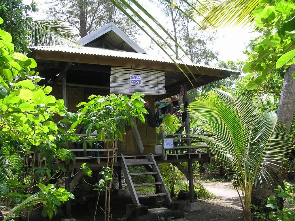
Hoga Island reveals itself gradually. The two-hour boat crossing from Wangi-Wangi navigates turquoise shallows until a forested ridge appears, backed by karst peaks. You wade ashore past outriggers painted cobalt and ochre, their hulls scarred by years of reef navigation. The beach itself runs barely four hundred meters, hemmed by coconut palms and the weathered planks of Bajo sea-nomad houses that lean into the prevailing wind.
The reef begins where most beaches end. At low tide, you can walk across sand ripples to the drop-off, where the seafloor plunges into channels thick with fusiliers and humphead wrasse. Villagers string laundry on lines above the high-tide mark; children somersault off piers into water so clear you count the spines on urchins ten feet below. There's no pretense here, no infrastructure designed for leisure—this is a working shoreline that happens to front some of Southeast Asia's healthiest coral.
Current carries you past walls
Ask first, share photos after
Rent from Operation Wallacea base
Where it is
Hoga Island Beach
Hoga Island, Southeast Sulawesi, Indonesia
-5.476000°, 123.778000°
Weather
Loading…
Swell
—
Temp
Warm · Restorative
UV Index
Moderate
Wind
—
Tidal State
Last known
Max Sunlight
—
Ideal Shade
—
May - Sep (Peak)
Jan - Dec (Off-season)
Historical data suggests peak visibility and stable sea temperatures occur during the prime visitation window.
Select a category to load nearby places.
Unlock restaurants, luxury stays and curated maritime experiences within 2km
Hoga Island Beach generally offers safe swimming conditions with calm, clear waters protected by surrounding reefs. The beach is ideal for snorkeling and diving, with minimal currents in most areas. However, always check local conditions before entering the water, as currents can vary. The coral reefs lie close to shore, so water shoes are recommended to protect your feet. There are no lifeguards on duty, so swim within your abilities and never alone.
Hoga Island can be visited year-round, though April to November offers the best conditions with calmer seas and optimal visibility for diving and snorkeling. The dry season from May to October brings less rainfall and more sunshine. December to March sees occasional rain and rougher seas, which can affect boat transfers, but the island remains accessible. Water temperatures stay warm throughout the year, averaging 27-29°C, making it consistently pleasant for swimming.
Reaching Hoga Island requires multiple steps. Fly to Bau-Bau on Buton Island via Makassar. From Bau-Bau, take a bus or private car to Lasalimu port (approximately 3 hours). From Lasalimu, arrange a boat transfer to Hoga Island, which takes 30-45 minutes depending on conditions. Most visitors coordinate transfers through their accommodation. There are no roads or vehicles on tiny Hoga Island itself, so parking isn't applicable—everything is reached on foot.
Hoga Island offers basic but comfortable accommodation, primarily at Operation Wallacea's research station and a few small guesthouses catering to divers and researchers. Meals are typically included with accommodation and feature simple Indonesian cuisine with fresh fish. Don't expect restaurants or shops—facilities are limited and rustic. Most visitors arrange full-board packages in advance. Bring snacks, sunscreen, and essentials from mainland Sulawesi, as supplies on the island are minimal.
Hoga Island sits within the Wakatobi Marine National Park, one of the world's most biodiverse coral reef systems. The house reef is accessible directly from the beach, offering exceptional snorkeling with pristine hard and soft corals, tropical fish, turtles, and occasional reef sharks just meters from shore. The island serves as a marine research station, contributing to conservation efforts. Its remote location means minimal tourist impact, resulting in remarkably healthy reefs rarely found elsewhere.