
Counting the waves…
Counting the waves…
A refined fusion of water purity, environmental stability, and communal vibrancy for Mitsukejima Beach.
View MethodologyAnalyzed via live sensors and environmental data.
Wave height, wind, and atmospheric stability.
Live footfall and crowd balance metrics.
Community reviews and curated sentiment.
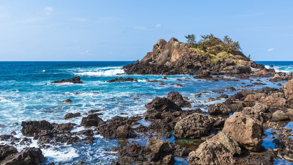
“You'll stand on volcanic boulders slick with spray, watching waves tear white ribbons around Gunkan-jima—the Battleship Island—whose sheer flanks glow amber in slanting afternoon light.”
Limited recent visitor reports — live OBI telemetry is your best guide for current conditions.
The engine-shaped rock formation looms fifty meters offshore, its serrated edges and weathered terraces carved by millennia of winter storms rolling in from Siberia. You'll pick your way across dark cobbles and tide-smoothed platforms, salt coating your lips, while cormorants wheel overhead and settle on ledges striped white with guano. The island's profile shifts as you move—prow, stern, gun turret—depending on where you stand along the uneven shoreline.
Local fishermen have left their nets to dry on wooden racks near the access road, the nylon mesh tangled with kelp. You'll smell brine and diesel fuel from the small harbor tucked behind the headland, where boats painted turquoise and orange bob against concrete pilings. In June, the surrounding hillsides erupt with wild lilies, their orange petals clashing magnificently with the cobalt sea.
Tropical beach hammock between palms
Long-tail boats moored in clear water
Multiple angles of rock formation
Navigate volcanic boulder platforms
Seabirds on offshore ledges
Prime Visitation
Best Weather
Where it is
Mitsukejima Beach
Suzu, Ishikawa, Japan
37.498200°, 137.281400°
Weather
Loading…
Swell
—
Temp
Warm · Restorative
UV Index
Moderate
Wind
—
Tidal State
Last known
Max Sunlight
—
Ideal Shade
—
May - Sep (Peak)
Jan - Dec (Off-season)
Historical data suggests peak visibility and stable sea temperatures occur during the prime visitation window.
Select a category to load nearby places.
Unlock restaurants, luxury stays and curated maritime experiences within 2km
Swimming at Mitsukejima Beach is generally not recommended due to its rocky coastline and potentially strong currents around the iconic Mitsukejima rock island. The beach is primarily a scenic viewing destination rather than a swimming spot. Visitors should stay on designated paths and viewing areas, especially when exploring the coastal cliffs. The terrain can be uneven and slippery, so proper footwear is essential. Always check local weather conditions before visiting, as waves can be unpredictable along this exposed northern coast.
The best time to visit Mitsukejima Beach is from late spring through early autumn (May to October) when weather conditions are most favorable for sightseeing and photography. Summer months offer the clearest skies and warmest temperatures, ideal for exploring the dramatic coastal scenery. Early morning or late afternoon provides the best lighting for photographing the iconic rock formation. Winter visits are possible but can be challenging due to cold winds and rough seas. Weekdays tend to be less crowded than weekends for capturing unobstructed photos of this Instagrammable landmark.
Mitsukejima Beach is located in Suzu, on the northern tip of the Noto Peninsula. The most practical way to reach it is by rental car, as public transportation is limited in this remote area. From Kanazawa, the drive takes approximately 2.5 hours via Route 249. The nearest train station is Noto Airport Station, but you'll still need a car or taxi from there. Local buses serve the Suzu area but have infrequent schedules. There's parking available near the beach viewing areas. GPS coordinates or a Japanese address are helpful for navigation.
Suzu city center, about 10-15 minutes from Mitsukejima Beach, offers various dining options including local seafood restaurants and casual eateries serving regional Noto cuisine. Accommodation options in Suzu include small hotels, ryokans (traditional Japanese inns), and minshuku (guesthouses). For more variety, Wajima, approximately 30 minutes away, has additional hotels and restaurants. Many visitors stay in larger towns like Wajima or Noto and visit Mitsukejima as a day trip. It's advisable to bring snacks and water as facilities directly at the beach are minimal.
Mitsukejima Beach is distinguished by its dramatic 28-meter-tall rock island rising from the sea, which resembles a ship's sail and is one of Noto Peninsula's most photographed landmarks. The name 'Mitsukejima' means 'discovery island,' based on a legend involving a Buddhist monk. Unlike sandy swimming beaches, this is primarily a scenic viewpoint offering spectacular coastal photography opportunities with rugged cliffs and rock formations. The area showcases the raw, untamed beauty of the northern Noto coastline, making it an essential stop for landscape photographers and nature enthusiasts visiting the region.
Photos