

Counting the waves…
Counting the waves…
A refined fusion of water purity, environmental stability, and communal vibrancy for Fortrose Beach.
View MethodologyAnalyzed via live sensors and environmental data.
Wave height, wind, and atmospheric stability.
Live footfall and crowd balance metrics.
Community reviews and curated sentiment.
“Fortrose village clusters at the bay's eastern edge, a few dozen homes and one general store facing the sea. The beach spreads westward—accessible, unspectacular, quietly lovely in the way of places that serve…”
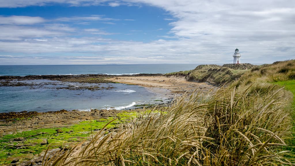
Limited recent visitor reports — live OBI telemetry is your best guide for current conditions.
You drive through sheep country to reach Fortrose, the road running straight across Southland's flat coastal plain before dropping to Toetoes Bay. The village announces itself with modest homes, a boat ramp, and the store where locals gather for milk and gossip. The beach begins where the Mataura River's mouth creates a lagoon, its waters stained tannin-brown from upstream wetlands, before spilling across sand into the ocean. Depending on tide and recent floods, the mouth shifts position, sometimes cutting deep channels, other times spreading shallow across the beach.
The sand is fine and grey-brown, scattered with shells and the occasional stranded jellyfish. Walking westward, you pass whitebait stands—simple frames where nets hang during season—and the odd bach set back in the dunes. The bay curves gently, offering views across to Toetoes Spit and the entrance where waves break over submerged sandbars. It's not a swimming beach in the tropical sense; the water stays cold and currents run strong near the river mouth. But on settled days, the shallows warm enough for children to splash, and kayakers paddle the lagoon, scanning for spoonbills and shags.
White cliffs over a desert beach
Sunset reflecting on wet sand
Lagoon and estuary exploration
Shells and coastal wandering
Tannin waters joining ocean
Prime Visitation
Anytime|Budget Travel
Where it is
Fortrose Beach
Fortrose, Southland, New Zealand
-46.578000°, 168.804900°
Weather
Loading…
Swell
—
Temp
Warm · Restorative
UV Index
Moderate
Wind
—
Tidal State
Last known
Max Sunlight
—
Ideal Shade
—
Jan - Dec (Peak)
Mar - Nov (Off-season)
Anytime|Budget Travel
Select a category to load nearby places.
Unlock restaurants, luxury stays and curated maritime experiences within 2km
Fortrose Beach on Toetoes Bay is generally family-friendly with calmer conditions than fully exposed coastlines, though parental supervision remains essential. There are no lifeguards, so swimming is at your own risk. Water temperatures are cold throughout the year, typical of Southland. The beach near the Mataura River mouth can have variable currents, particularly during tidal changes. Check conditions locally before swimming. The accessible, quiet setting makes it suitable for beach play and paddling with appropriate caution and supervision.
Fortrose Beach can be visited year-round, making it suitable for budget travellers and flexible schedules. Summer (December-February) provides the warmest weather and longest daylight, though temperatures remain moderate by New Zealand standards. The beach's quiet local feel means it's rarely crowded regardless of season. Sunset visits are particularly scenic with views across Toetoes Bay. Autumn and spring offer pleasant conditions with even fewer visitors. Winter visits appeal to those seeking solitude and dramatic coastal weather.
Fortrose is located on the Southern Scenic Route approximately 60 kilometres east of Invercargill. Drive via State Highway 92 through the Catlins region; the route is well-signposted and scenic. The beach is easily accessible from the small settlement of Fortrose with roadside parking available. A private vehicle is essential as no public transport services this area. The drive takes roughly one hour from Invercargill on sealed roads. Ensure adequate fuel as service stations become sparse in this rural region.
Fortrose itself is a very small settlement with minimal visitor facilities. Accommodation is extremely limited; occasional holiday homes may be available but aren't widely advertised. There are no restaurants or cafes in Fortrose. The nearest services are in larger Catlins towns or back toward Invercargill. Visitors should bring food and supplies from Invercargill or other provisioned towns. Most travellers visit Fortrose as a day trip while staying in Invercargill or traveling the Southern Scenic Route with accommodation booked elsewhere.
Fortrose Beach offers an authentic local coastal experience near the Mataura River mouth, largely overlooked by tourist circuits despite being on the Southern Scenic Route. Its accessible location combined with quiet, uncommercialised character provides genuine Southland atmosphere. The Toetoes Bay setting creates scenic surroundings with a more sheltered feel than fully exposed coastlines. The beach reflects working coastal community life rather than resort atmosphere. It's ideal for budget-conscious travellers and those seeking understated beauty and peaceful surroundings without facilities or crowds.
Photos