
Counting the waves…
Counting the waves…
A refined fusion of water purity, environmental stability, and communal vibrancy for Katrina Cut Beach.
View MethodologyAnalyzed via live sensors and environmental data.
Wave height, wind, and atmospheric stability.
Live footfall and crowd balance metrics.
Community reviews and curated sentiment.
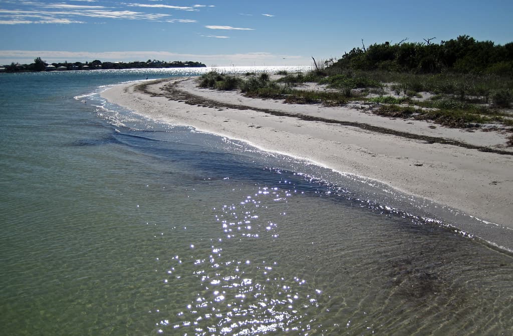
“You'll find Katrina Cut Beach where the 2005 storm severed Dauphin Island in two, leaving a shallow channel that shimmers between dunes and marsh grass. Wade through ankle-deep water at low tide, watch brown pelicans…”
Limited recent visitor reports — live OBI telemetry is your best guide for current conditions.
The name tells you everything: Hurricane Katrina didn't just batter this seven-mile barrier island—it split it clean through, creating a tidal cut that transformed the eastern end into a wild, rewashed landscape. Where pavement once ran, you now navigate soft sand roads and footpaths threading between wire grass and sea oats, the island's spine visibly broken and beautifully unrepaired.
You'll wade into bathwater-warm shallows on the Sound side, then cross the narrow island width—sometimes just a few hundred yards—to meet the Gulf's livelier surf. The beach itself sprawls wide and empty, littered with bleached oyster shells and driftwood sculpture, framed by the distant silhouette of Fort Gaines to the west. Sandbars shift with every storm, creating tide pools where hermit crabs scuttle and ghost shrimp burrow.
Grassy wetland scene with calm water bodies and a building.
A dolphin leaps from the ocean near a sandy island.
Driftwood sculptures and erosion patterns
Cross between Sound and Gulf
Follow ever-changing sandbars east
Where it is
Katrina Cut Beach
Dauphin Island, Alabama, USA
30.248500°, -88.278900°
Weather
Loading…
Swell
—
Temp
Warm · Restorative
UV Index
Moderate
Wind
—
Tidal State
Last known
Max Sunlight
—
Ideal Shade
—
May - Sep (Peak)
Jan - Dec (Off-season)
Historical data suggests peak visibility and stable sea temperatures occur during the prime visitation window.
Select a category to load nearby places.
Unlock restaurants, luxury stays and curated maritime experiences within 2km
Swimming conditions at Katrina Cut Beach vary and require caution. This area features a natural cut created by Hurricane Katrina, resulting in strong currents where Mobile Bay meets the Gulf of Mexico. The channel can have unpredictable tides and currents, making it potentially dangerous for inexperienced swimmers. There are no lifeguards on duty. Always check local weather conditions, avoid swimming alone, and be particularly careful during high tide or after storms. The beach is more suitable for wading and beachcombing than serious swimming.
Katrina Cut Beach is accessible year-round, with each season offering different experiences. Spring (March-May) and fall (September-November) provide mild temperatures, fewer crowds, and excellent bird watching during migration seasons. Summer (June-August) brings warm Gulf waters but higher humidity and more visitors. Winter months are quieter with cooler temperatures, ideal for shelling and solitary beach walks. Hurricane season runs June through November, so monitor weather forecasts. Early morning visits any time of year offer the best shelling opportunities and wildlife viewing.
Katrina Cut Beach is located on the eastern end of Dauphin Island, accessible via Bienville Boulevard heading east from the main town area. Continue past the Audubon Bird Sanctuary toward the island's tip. Parking is available in sandy pull-off areas along the road near the beach access points. The area is undeveloped, so parking is informal and free but limited. A vehicle with decent clearance is helpful as some areas have soft sand. The beach is approximately 3 miles from the Dauphin Island ferry terminal.
Katrina Cut Beach is a remote, undeveloped area with no on-site amenities, restaurants, or facilities. You'll need to bring your own food, water, and supplies, and pack out all trash. The nearest restaurants, shops, and public restrooms are in Dauphin Island's main town area, about 3-4 miles west. Lodging options on Dauphin Island include vacation rentals, beachfront condos, and a few small hotels and campgrounds, all located in the more developed western portions of the island. Plan accordingly before visiting this isolated beach.
Katrina Cut Beach gets its name from Hurricane Katrina, which struck in 2005 and literally cut through Dauphin Island's eastern end, creating a new waterway. This natural channel dramatically reshaped the island's geography, splitting the landmass temporarily. The area showcases nature's powerful transformative forces and has since evolved into a unique ecosystem where bay and Gulf waters mix. It's popular with shellers, bird watchers, and photographers seeking an undeveloped, wild beach experience. The ever-changing landscape continues to shift with storms and tides.
Photos