Counting the waves…
Counting the waves…
A refined fusion of water purity, environmental stability, and communal vibrancy for Jug Handle Beach.
View MethodologyAnalyzed via live sensors and environmental data.
Wave height, wind, and atmospheric stability.
Live footfall and crowd balance metrics.
Community reviews and curated sentiment.
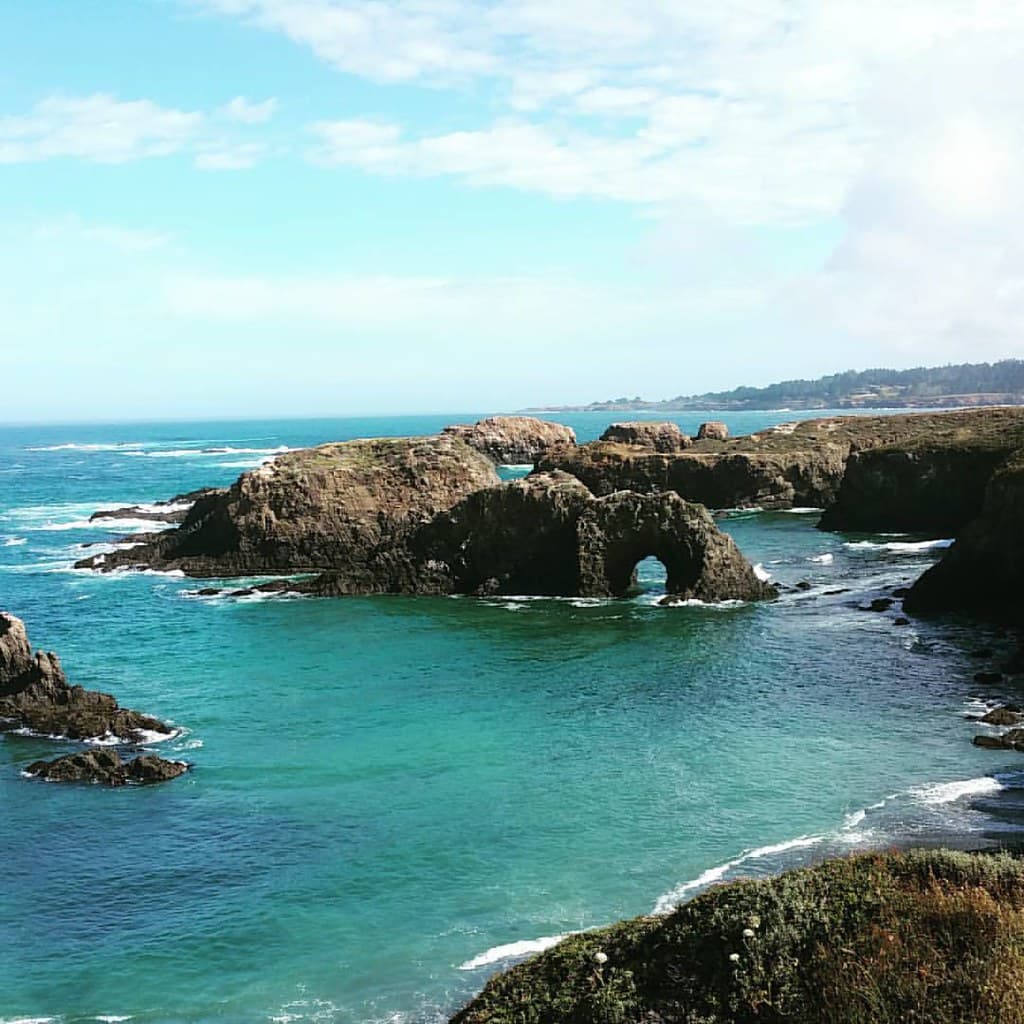
“You descend a narrow trail past wind-sculpted pines to find a pocket beach hemmed by wave-cut bluffs and tidal shelves. The air smells of salt spray and kelp. Behind you, the Jug Handle State Natural Reserve climbs…”
Limited recent visitor reports — live OBI telemetry is your best guide for current conditions.
The beach takes its name from the jug-shaped handle of rock visible at low tide, a geological flourish that hints at the drama underfoot. You'll share the sand with driftwood logs bleached silver by winter storms, harbor seals hauled out on offshore rocks, and the occasional beachcomber scanning tide pools for purple urchins and ochre stars. The cove is small—a few hundred yards of coarse sand and cobble—but the sense of seclusion is outsized, buffered as it is by the reserve's sprawling acreage.
Most visitors treat Jug Handle as a starting point for the Ecological Staircase Trail, a five-mile loop that ascends through pygmy forests and ancient marine terraces. But linger at sea level and you'll notice the layers: dark bands of chert in the cliffs, the rhythmic crash of swells against bedrock shelves, the way fog clings to the headlands before burning off by noon. The beach faces northwest, so sunsets arrive obliquely, painting the kelp beds amber.
 Credit: Unsplash
gray and brown mountain beside body of water
 Credit: Unsplash
aerial view of beach with blue ocean water during daytime
Five terraces through geologic time
Anemones cling to basalt shelves
Seal-watch from weathered logs
Where it is
Jug Handle Beach
Caspar, California, USA
39.365000°, -123.822000°
Weather
Loading…
Swell
—
Temp
Warm · Restorative
UV Index
Moderate
Wind
—
Tidal State
Last known
Max Sunlight
—
Ideal Shade
—
May - Sep (Peak)
Jan - Dec (Off-season)
Historical data suggests peak visibility and stable sea temperatures occur during the prime visitation window.
Select a category to load nearby places.
Unlock restaurants, luxury stays and curated maritime experiences within 2km
Jug Handle Beach is generally not recommended for swimming due to typical Northern California coast conditions. The water remains cold year-round (50-55°F), and strong currents, unpredictable waves, and occasional rip currents make it hazardous. The beach is better suited for tidepooling, beachcombing, and coastal walks. Always stay aware of sneaker waves that can appear without warning along the Mendocino Coast. If you do wade, stay close to shore and never turn your back on the ocean.
Jug Handle Beach is accessible year-round, with each season offering something different. Summer (June-August) brings calmer seas and clearer skies, ideal for exploring tidepools and hiking the adjacent Ecological Staircase Trail. Spring wildflowers bloom beautifully along the bluffs. Fall offers fewer crowds and dramatic coastal scenery. Winter storms create spectacular wave watching but bring rain. Mornings typically offer the clearest weather before coastal fog rolls in during afternoons. Low tide periods are best for exploring marine life.
Jug Handle Beach is located along Highway 1, approximately 5 miles north of Mendocino and 1 mile south of Caspar. Look for the Jug Handle State Natural Reserve entrance on the west side of the highway. Free parking is available in a small lot near the trailhead. A short trail leads from the parking area down to the beach. The access trail can be steep and potentially slippery, so wear sturdy footwear. Arrive early during summer weekends as parking is limited.
Jug Handle Beach has no on-site amenities, so plan accordingly. The tiny village of Caspar, one mile north, has limited services. Your best options are in Mendocino (5 miles south), which offers numerous restaurants, cafes, inns, and B&Bs. Fort Bragg (7 miles north) provides more extensive dining, grocery stores, and varied accommodations from budget motels to vacation rentals. Bring your own food, water, and supplies for beach visits, as facilities are minimal in this relatively remote coastal area.
The Ecological Staircase Trail is a unique 5-mile round-trip hike starting from Jug Handle Beach that showcases five distinct wave-cut terraces formed over 500,000 years. Each terrace represents a different geological time period, with ecosystems ranging from coastal bluffs to pygmy forest. The trail climbs gradually through these natural 'steps,' offering an extraordinary example of coastal geology and ecology. It's one of California's most distinctive nature walks, demonstrating how ancient sea levels shaped today's landscape.
Photos