Counting the waves…
Counting the waves…
A refined fusion of water purity, environmental stability, and communal vibrancy for Cape Hatteras Beach.
View MethodologyAnalyzed via live sensors and environmental data.
Wave height, wind, and atmospheric stability.
Live footfall and crowd balance metrics.
Community reviews and curated sentiment.
“You'll feel the Atlantic's raw energy the moment you step onto this wind-scraped barrier island. The striped lighthouse rises behind dunes that hiss with blowing sand, while breakers thunder onto shore with a force that…”
Limited recent visitor reports — live OBI telemetry is your best guide for current conditions.
The beach at Buxton bends like an elbow where the Outer Banks jut farthest into the Atlantic, and that geography makes all the difference. Here, competing ocean currents collide, stirring up sandbars that shift daily and waves that can swell to double-overhead on a good northeast wind. You'll share the lineup with seasoned locals who've memorized every shoal and rip, their pickups parked in the sandy pullouts along Highway 12, board racks gleaming in the salt air.
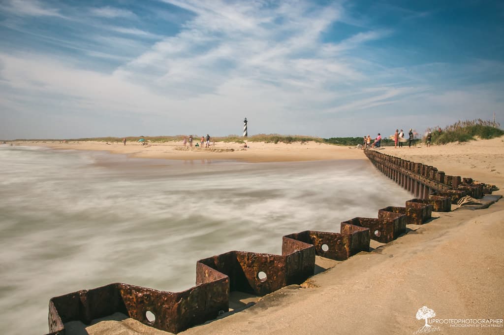
Beyond the break, the beach itself stretches for miles in both directions—a study in minimalism. Dune grass bends horizontal in the constant wind. Ghost crabs skitter across ridges of compacted sand. The iconic black-and-white spiral of the Cape Hatteras Lighthouse watches over it all from its perch a half-mile inland, relocated in 1999 to escape the encroaching sea that now laps closer each year.
man in green and brown jacket walking on beach during daytime
man in black and red jacket carrying white surfboard
Powerful breaks shift with sandbars
Iconic spiral against pink sky
Windswept paths through maritime forest
Where it is
Cape Hatteras Beach
Buxton, North Carolina, USA
35.251000°, -75.528500°
Weather
Loading…
Swell
—
Temp
Warm · Restorative
UV Index
Moderate
Wind
—
Tidal State
Last known
Max Sunlight
—
Ideal Shade
—
May - Sep (Peak)
Jan - Dec (Off-season)
Historical data suggests peak visibility and stable sea temperatures occur during the prime visitation window.
Select a category to load nearby places.
Unlock restaurants, luxury stays and curated maritime experiences within 2km
Cape Hatteras has strong currents, unpredictable rip tides, and powerful waves, making it more challenging than typical East Coast beaches. The beach is unguarded in most areas, so swimming requires caution and experience. Check local surf reports and weather conditions before entering the water. Red flags indicate dangerous conditions. The area where the Atlantic Ocean meets the Gulf Stream creates particularly hazardous swimming conditions. Families with young children should seek calmer spots near the sound side or stick to wading in shallow areas during mild weather.
Late spring through early fall (May-September) offers the warmest weather and water temperatures, ideal for swimming and water sports. Hurricane season runs June through November, with peak activity August-October. Fall (September-November) brings excellent surf conditions and fewer crowds, making it prime time for surfers and anglers. Summer sees the most visitors and highest accommodation prices. Winter and early spring offer solitude and bird-watching opportunities but cold water and air temperatures. Year-round access makes it suitable for off-season beach walks and lighthouse visits.
Cape Hatteras Beach is located in Buxton on North Carolina's Outer Banks, accessed via Highway 12. From the mainland, take US-64 or US-158 to the Outer Banks, then follow NC-12 south through several towns to reach Buxton. Multiple public beach access points offer free parking lots along Highway 12. Four-wheel drive vehicles with permits can access designated off-road areas on the beach. The nearest major airport is Norfolk International (approximately 120 miles). No bridge tolls apply, but allow extra travel time during summer weekends.
Buxton offers several restaurants, including seafood spots and casual eateries, plus grocery stores for self-catering. The village has motels, vacation rental homes, and campgrounds within the Cape Hatteras National Seashore. Nearby villages like Avon and Frisco provide additional dining and shopping options. Amenities are more limited than northern Outer Banks towns, so plan accordingly. The Cape Hatteras Lighthouse area has visitor facilities and restrooms. For wider selection of restaurants and accommodations, Hatteras village is 10 miles south, while more extensive options exist in Nags Head, about 50 miles north.
Cape Hatteras is renowned as the surfing capital of the East Coast due to its position where the Labrador Current meets the Gulf Stream, creating consistent, powerful waves. The Diamond Shoals offshore produce world-class swells, particularly during hurricane season and winter nor'easters. Multiple surf breaks accommodate various skill levels, though conditions generally suit intermediate to advanced surfers. The beach hosts surfing competitions and attracts dedicated wave-riders year-round. Fall typically delivers the best surf conditions with offshore winds and Atlantic storm swells, earning Cape Hatteras its reputation among serious surfers nationwide.
Photos