
Counting the waves…
Counting the waves…
A refined fusion of water purity, environmental stability, and communal vibrancy for Playa Punta Manicuare Sur.
View MethodologyAnalyzed via live sensors and environmental data.
Wave height, wind, and atmospheric stability.
Live footfall and crowd balance metrics.
Community reviews and curated sentiment.
“The point rises from the gulf in layers of sedimentary rock tilted and fractured by tectonic history you can read like pages. Waves attack the shore with rhythmic persistence, polishing stone and filling the air with…”
Limited recent visitor reports — live OBI telemetry is your best guide for current conditions.
Stand where the peninsula narrows to a rocky finger pointing into the gulf, and you're standing on geology in motion. The stone beneath your feet tells a story in strata—layers of sediment compressed into rock, then lifted and tilted by the same forces that built the Andes. Waves have carved the softer layers into hollows and shelves, leaving harder bands standing proud, creating a landscape of horizontal lines and wind-sculpted forms.
The shore here belongs to stone and sea, not sand. You'll find pockets of coarse gravel in protected corners, deposits of shells crushed to fragments by wave action, but mostly it's rock in shades of grey and rust-brown. Seabirds favor the point—pelicans dive just offshore, their bodies arrowing into the water with startling force, while frigates patrol higher altitudes, their forked tails distinctive against the sky.
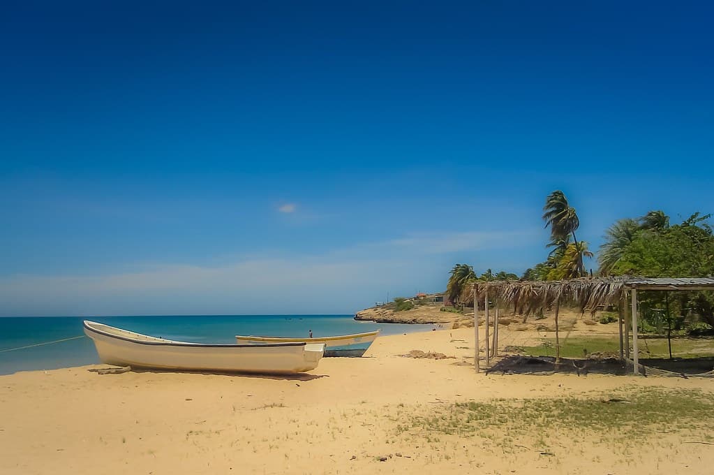
A man standing on top of a sandy beach under palm trees
A sign that is on the side of a beach
Sedimentary layers, wave-carved forms
Tectonic storytelling in stone
Strong swimmers, careful entry
Prime Visitation
Best Weather|Less Crowds
Where it is
Playa Punta Manicuare Sur
Manicuare, Sucre, Venezuela
10.536800°, -64.200700°
Weather
Loading…
Swell
—
Temp
Warm · Restorative
UV Index
Moderate
Wind
—
Tidal State
Last known
Max Sunlight
—
Ideal Shade
—
Jan - Dec (Peak)
May - Nov (Off-season)
Best Weather|Less Crowds
Select a category to load nearby places.
Unlock restaurants, luxury stays and curated maritime experiences within 2km
Swimming at Playa Punta Manicuare Sur requires extra caution due to its rocky nature. The rocky shoreline and point formation can create unpredictable currents and underwater hazards. This beach is better suited for wading, exploring tide pools, and enjoying the coastal scenery rather than traditional swimming. If you do enter the water, wear protective footwear to navigate the rocks safely, stay close to shore, and be mindful of wave action against the rocks. The gulf-facing location generally means calmer conditions than open ocean, but rocky points always demand respect and careful assessment.
The optimal time to visit Playa Punta Manicuare Sur is during Venezuela's dry season from December to April when weather is most reliable for photography and exploration. The combination of best weather and fewer crowds makes this period ideal for capturing the Instagrammable rocky landscape and sunset views. Golden hour, particularly late afternoon approaching sunset, offers the most dramatic lighting for this scenic point. Weekdays provide more solitude than weekends. Low tide periods are best for exploring the rocky shoreline safely, so check tide schedules if possible before your visit.
Playa Punta Manicuare Sur is located near the town of Manicuare on the Araya Peninsula's southern coast. From Cumaná, travel along the road that follows the Gulf of Cariaco shoreline toward Araya. The point is separate from Manicuare's main beach area, so you'll need to navigate to the specific southern point location. Local knowledge can be helpful in finding the exact spot. Roads on the peninsula vary in condition, and a sturdy vehicle is recommended. Public transport may get you to Manicuare town, but reaching the specific point may require walking or local arrangements.
Food and lodging options near Playa Punta Manicuare Sur are found in the nearby town of Manicuare rather than at the rocky point itself. The town offers basic local accommodations, small guesthouses, and family-run restaurants serving fresh seafood and Venezuelan dishes. Facilities are simple and budget-oriented, reflecting the area's authentic, non-touristy character. For this type of hidden, scenic spot, many visitors come for photography or exploration rather than extended stays. Bring snacks and water for your visit to the point, and plan meals in town or nearby communities along the Gulf of Cariaco.
Playa Punta Manicuare Sur distinguishes itself through its rocky point geography, contrasting with any sandy areas in main Manicuare. The point's dramatic rock formations create exceptional photo opportunities, particularly at sunset when the gulf waters and rocky landscape combine for Instagrammable scenes. This location offers a more rugged, scenic experience focused on landscape appreciation rather than traditional beach activities like sunbathing or swimming. The separate identity from the main beach means fewer visitors and a more pristine natural setting. Its southern gulf-facing orientation provides unique perspectives of the Cariaco shoreline and distinct sunset viewing angles.
Photos