Counting the waves…
Counting the waves…
A refined fusion of water purity, environmental stability, and communal vibrancy for Hinchinbrook Island Beach.
View MethodologyAnalyzed via live sensors and environmental data.
Wave height, wind, and atmospheric stability.
Live footfall and crowd balance metrics.
Community reviews and curated sentiment.
“You step off the ferry onto sand so untouched that ghost crabs scatter in surprise. The air smells of eucalyptus and brine, and behind you, dense mangroves give way to mountains draped in mist. Ahead: nothing but empty…”
Limited recent visitor reports — live OBI telemetry is your best guide for current conditions.
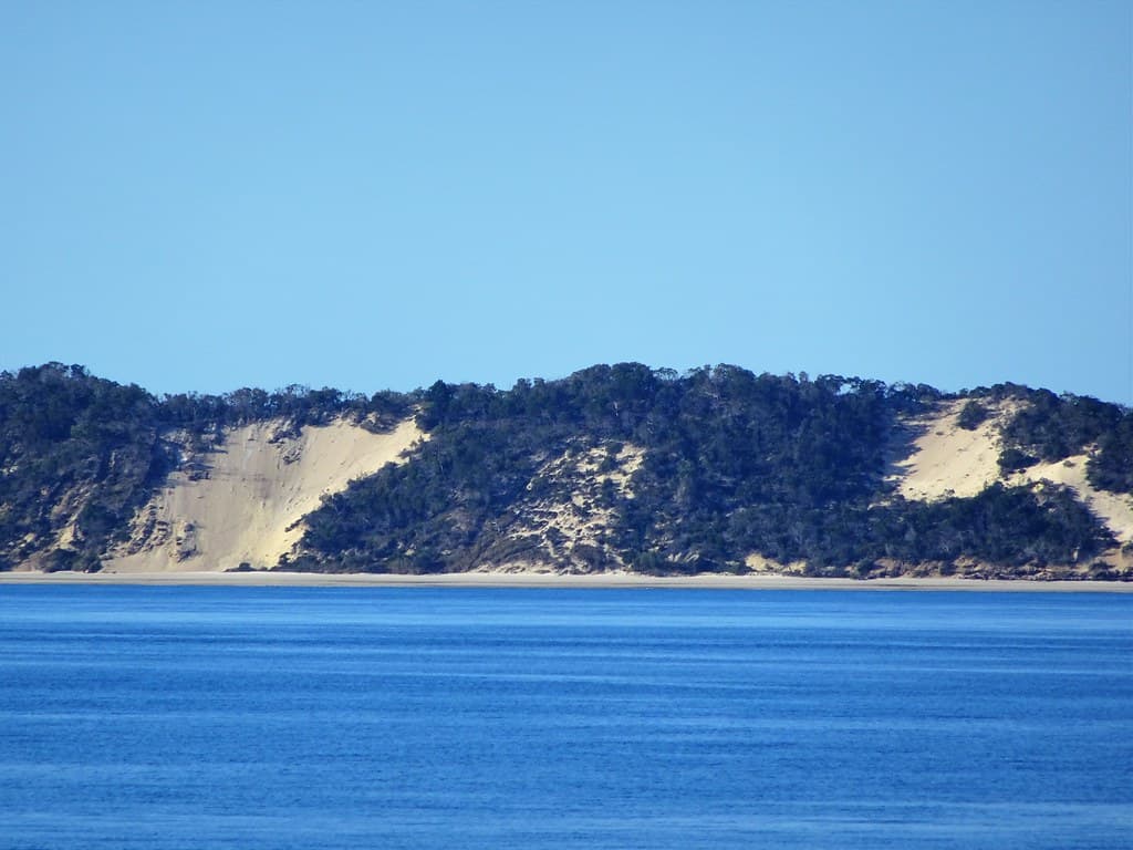
Hinchinbrook Island Beach unfolds along Australia's largest island national park, a 52,000-hectare wilderness where the Great Barrier Reef meets the Wet Tropics rainforest. You arrive by boat—there's no bridge, no road—and the moment your feet touch the fine beige sand, the mainland world evaporates. Wallabies browse along the tree line at dawn. Curlews call from mudflats. The only infrastructure is a handful of rustic campsites tucked beneath she-oaks and paperbarks.
The Thorsborne Trail, a 32-kilometer coastal trek, traces the island's eastern shore past waterfalls, tidal creeks, and boulder-strewn coves. But you don't need to hike the entire route to taste the island's wildness. Day-trippers stake out secluded stretches near Ramsay Bay or Macushla, where the sand is flour-soft and the water shifts from jade to deep indigo. Saltwater crocodiles inhabit the mangrove estuaries, so you swim only where locals advise. Tides dictate everything: your launch time, your beach access, your chance of spotting rays gliding over sandbars.
Credit: FlickrThorsborne Trail
Credit: FlickrMangrove Channels
Multi-day trek through wilderness
Paddle tidal creeks carefully
Rainforest meets empty shore
Where it is
Hinchinbrook Island Beach
Hinchinbrook Island, Queensland, Australia
-18.252700°, 146.254900°
Weather
Loading…
Swell
—
Temp
Warm · Restorative
UV Index
Moderate
Wind
—
Tidal State
Last known
Max Sunlight
—
Ideal Shade
—
May - Sep (Peak)
Jan - Dec (Off-season)
Historical data suggests peak visibility and stable sea temperatures occur during the prime visitation window.
Select a category to load nearby places.
Unlock restaurants, luxury stays and curated maritime experiences within 2km
Swimming conditions vary around Hinchinbrook Island's beaches. During November to May, dangerous marine stingers including box jellyfish are present in coastal waters, making swimming hazardous without protective clothing. Crocodiles inhabit these waters year-round, particularly near mangroves and river mouths. Always observe warning signs and avoid swimming at dawn, dusk, or in murky water. The island's eastern beaches generally have stronger currents and surf. There are no lifeguards, medical facilities, or phone coverage, so exercise extreme caution and consider wearing stinger suits during wet season.
The dry season from May to September offers the most comfortable conditions for visiting Hinchinbrook Island, with lower humidity, minimal rainfall, and temperatures between 17-26°C. This period is ideal for hiking the Thorsborne Trail and beach exploration. October to April brings the wet season with high humidity, heavy rainfall, and extreme heat. Cyclones can occur December to April. Marine stingers are prevalent November to May. Many visitors prefer June to August for optimal weather, though the island remains accessible year-round for experienced, well-prepared adventurers.
Hinchinbrook Island is only accessible by boat, with no bridges or vehicle access. Licensed ferry services operate from Cardwell and Lucinda on the mainland, approximately 180km north of Townsville. Hinchinbrook Wilderness Safaris and other operators provide transfers to various island locations. Journey time is typically 30-45 minutes depending on destination and conditions. Private boat owners can also access the island. Permits are required for camping and hiking the Thorsborne Trail, which must be booked months in advance through Queensland Parks. There are no roads, vehicles, or parking facilities on the island itself.
Hinchinbrook Island has no permanent facilities, shops, restaurants, or commercial accommodation. It's a national park wilderness area with only basic bush camping sites along the Thorsborne Trail and designated camping zones at places like Macushla and Scraggy Point. Visitors must be completely self-sufficient, bringing all food, water, camping equipment, and supplies. There's no phone coverage, electricity, or fresh water sources. The nearest accommodation, restaurants, and shops are in Cardwell or Ingham on the mainland. This is a serious wilderness experience requiring thorough preparation and backcountry camping skills.
The Thorsborne Trail is consistently rated among Australia's finest multi-day coastal wilderness hikes. This 32-kilometer track traverses the island's east coast through pristine rainforest, eucalypt woodland, mangroves, and secluded beaches virtually untouched by development. The trail typically takes 3-4 days to complete and offers exceptional wildlife viewing including wallabies, goannas, and diverse birdlife. Only 40 hikers can start the trail daily, preserving its wilderness character. The challenging terrain, creek crossings, and complete isolation create an authentic adventure requiring good fitness and navigation skills, with no marked emergency exits.
Photos