
Counting the waves…
Counting the waves…
A refined fusion of water purity, environmental stability, and communal vibrancy for Pormpuraaw Beach.
View MethodologyAnalyzed via live sensors and environmental data.
Wave height, wind, and atmospheric stability.
Live footfall and crowd balance metrics.
Community reviews and curated sentiment.
“You'll drive six hours north of Cairns—past the last sealed road—to reach this windswept Gulf beach where Thaayorre elders still harvest seafood at low tide. The sand here is caramel-brown, the water opaque with…”
Limited recent visitor reports — live OBI telemetry is your best guide for current conditions.
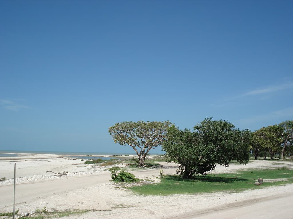
Pormpuraaw Beach unfurls along the eastern shore of the Gulf of Carpentaria, where saltwater country stretches flat and endless beneath skies that seem to press down with physical weight. The strand itself is wide and firm, ribboned with tidal channels that shift daily, and backed by mangroves whose roots claw into the mud like arthritic fingers. This isn't postcard Australia—there are no white sands or reef corals here—but something rawer: a working shoreline where the Thaayorre people have fished, hunted, and navigated by seasonal winds for millennia.
You'll arrive dusty and road-weary, having negotiated washboard corrugations and creek crossings to reach this remote Aboriginal community of fewer than a thousand souls. The beach reveals itself gradually: first the smell of brine and decomposing seagrass, then the cacophony of waders—godwits, sandpipers, curlews—probing the exposed flats. At high tide, the Gulf pushes brown water against the shore with surprising force; at low, the horizon retreats two hundred meters, leaving behind a glistening plain dimpled with crab holes.
Dawn low-tide brings thousands
Local catches September through December
Walk exposed seabed at ebb
Where it is
Pormpuraaw Beach
Pormpuraaw, Queensland, Australia
-14.305200°, 142.749900°
Weather
Loading…
Swell
—
Temp
Warm · Restorative
UV Index
Moderate
Wind
—
Tidal State
Last known
Max Sunlight
—
Ideal Shade
—
May - Sep (Peak)
Jan - Dec (Off-season)
Historical data suggests peak visibility and stable sea temperatures occur during the prime visitation window.
Select a category to load nearby places.
Unlock restaurants, luxury stays and curated maritime experiences within 2km
Swimming at Pormpuraaw Beach requires extreme caution due to the presence of saltwater crocodiles, strong currents, and marine stingers during certain seasons. The remote location means no lifeguard patrols or safety equipment. Crocodiles inhabit coastal waters in this region year-round, making swimming generally inadvisable. If you choose to enter the water, stay close to shore, never swim alone, and be vigilant. Always check with local authorities or community members about current conditions and wildlife sightings before considering any water activities.
The dry season from May to October offers the most comfortable conditions for visiting Pormpuraaw Beach, with lower humidity, minimal rainfall, and cooler temperatures averaging 25-30°C. The wet season (November to April) brings heavy rains, high humidity, extreme heat, and potential flooding that can make access difficult. During dry months, you'll enjoy clearer skies and better road conditions. However, the remote location means year-round visits are possible if you're prepared for tropical conditions and have reliable transportation.
Pormpuraaw is an extremely remote Indigenous community on Queensland's western Cape York Peninsula, accessible primarily by light aircraft from Cairns (approximately 90-minute flight). Road access via the Peninsula Developmental Road is possible during dry season with a well-equipped 4WD vehicle, but requires careful planning and multiple days of driving. Access to the beach and community requires a permit from the Pormpuraaw Aboriginal Shire Council. Parking arrangements are informal, and visitors must respect community protocols and private property when visiting.
Pormpuraaw has very limited visitor facilities. There's a small community store with basic supplies, but no restaurants, hotels, or tourist accommodations. Visitors typically need to arrange accommodation through community contacts or bring camping equipment if permitted. It's essential to bring sufficient food, water, and supplies from Cairns or other major centres, as the local store primarily serves residents and has limited inventory. All visits should be arranged in advance with the Aboriginal Shire Council, who can provide guidance on appropriate accommodation arrangements.
Yes, Pormpuraaw is an Indigenous community, and visitors must obtain a permit from the Pormpuraaw Aboriginal Shire Council before arrival. This applies to both the township and surrounding areas, including the beach. The permit system helps protect community privacy and cultural sites while managing tourism respectfully. Applications should be submitted well in advance of your intended visit. Respect for local customs, cultural sensitivity, and following community guidelines are essential. Unauthorized visits are not permitted, and travellers should understand this is a living community, not a tourist destination.