Counting the waves…
Counting the waves…
A refined fusion of water purity, environmental stability, and communal vibrancy for Campo River Coastal Beach.
View MethodologyAnalyzed via live sensors and environmental data.
Wave height, wind, and atmospheric stability.
Live footfall and crowd balance metrics.
Community reviews and curated sentiment.
“Stand where two nations meet and a mighty river embraces the sea. Campo River Coastal Beach offers a compelling landscape where the freshwater currents of the Campo River merge with the vastness of the Atlantic, marking…”
Limited recent visitor reports — live OBI telemetry is your best guide for current conditions.
Campo River Coastal Beach is more than just a stretch of sand; it's a geographical landmark where the Campo River, forming a natural border, flows into the Atlantic Ocean. This confluence creates a dynamic estuary, a rich ecosystem where freshwater and saltwater species coexist and thrive. The landscape is a fascinating blend of riverine vegetation giving way to coastal palms and sandy shores.
Walking along this beach, you'll witness the distinct patterns of the river's outflow meeting the ocean's tides. The water's color shifts from the earthy tones of the river to the deeper blues of the sea, a visual testament to the powerful forces at play. The air carries the scent of both fresh water and salt, a unique olfactory experience that speaks to the beach's dual nature.
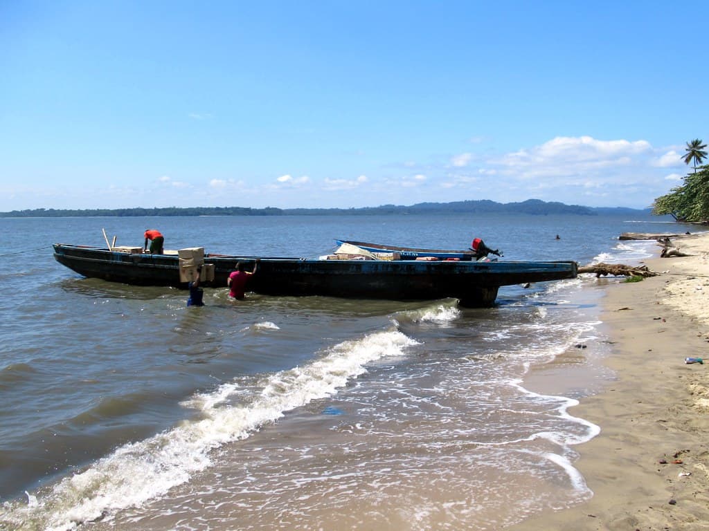
Long-tail boats moored in clear water
Crystal lagoon with rocky outcrop
Observe two nations
Unique ecosystem walk
Birds and marine life
Prime Visitation
Anytime
Where it is
Campo River Coastal Beach
Border Coast, Litoral, Equatorial Guinea
1.020000°, 9.550000°
Weather
Loading…
Swell
—
Temp
Warm · Restorative
UV Index
Moderate
Wind
—
Tidal State
Last known
Max Sunlight
—
Ideal Shade
—
Jan - Dec (Peak)
May - Nov (Off-season)
Historical data suggests peak visibility and stable sea temperatures occur during the prime visitation window.
Select a category to load nearby places.
Unlock restaurants, luxury stays and curated maritime experiences within 2km
Swimming at Campo River Coastal Beach, an estuary on the border, requires caution. Estuaries can have complex currents where river and ocean waters meet. Additionally, being a border area, it's wise to be aware of local regulations or restrictions. Water quality might also vary. It's best to observe local conditions, avoid strong currents, and inquire locally about any specific safety guidelines before entering the water. Lifeguards are unlikely to be present.
Campo River Coastal Beach is suitable for visiting 'anytime,' making it accessible for nature observation throughout the year. For optimal viewing of wildlife and enjoying the natural river mouth environment, consider visiting during quieter times of day, such as early mornings or late afternoons, when animals are often more active. Avoiding periods of heavy rain will also enhance the experience of exploring this natural setting.
Accessing Campo River Coastal Beach, located on the Border Coast in Litoral, Equatorial Guinea, would involve navigating to the specific border region. Transportation would likely be via private vehicle or local transport services from the nearest towns. Due to its border location, visitors should ensure they have all necessary travel documents and are aware of any specific entry or access regulations for the area before planning their trip.
Given its description as a 'border estuary' and focus on 'nature' and 'river mouth,' Campo River Coastal Beach is highly unlikely to have direct food and lodging facilities. Visitors should plan to bring all necessary provisions, including food and water, for their visit. Accommodations and dining would need to be sought in the nearest towns or settlements, which might be some distance away from the immediate beach area.
Campo River Coastal Beach's significance lies in its unique position as a 'border estuary.' This means it's where the Campo River meets the ocean, forming a distinct ecosystem, and it also marks a geographical boundary. This dual role makes it an interesting site for both ecological study and understanding regional geography. It offers a unique perspective on natural boundaries and the interplay of river and marine environments.
Photos