Counting the waves…
Counting the waves…
A refined fusion of water purity, environmental stability, and communal vibrancy for Kiritehere Beach.
View MethodologyAnalyzed via live sensors and environmental data.
Wave height, wind, and atmospheric stability.
Live footfall and crowd balance metrics.
Community reviews and curated sentiment.
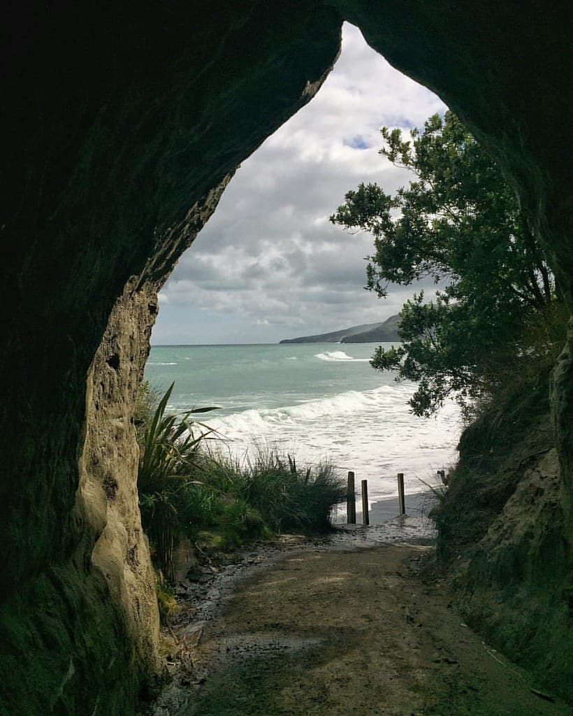
“The unsealed road descends through farmland that gives way to wind-pruned coastal scrub, then suddenly the ocean spreads before you: dark sand, white breakers, and cliffs marching south until perspective collapses them…”
Limited recent visitor reports — live OBI telemetry is your best guide for current conditions.
Kiritehere sits at the end of the line—literally. The road terminates at a small parking area where a track drops through lupin and marram grass to black volcanic sand. The beach curves into a shallow bay, cliffs rising on both ends like geological bookends. Swells refract around the southern headland, creating wave patterns that intersect and amplify, producing unpredictable surge along the shore.
Driftwood litters the high-tide line in astonishing variety: entire tree trunks with root systems still attached, fence posts, dock timbers, shapes sanded smooth enough to read like abstract sculpture. The wood comes from rivers draining the Volcanic Plateau and King Country farmland, carried to sea during floods then deposited here by longshore drift. Salt and sun have bleached everything to bone white and silver.
 Credit: Unsplash
bird's eye view of body of water near mountain
 Credit: Unsplash
aerial view of beach during daytime
Salt-sculpted timber monuments
Layered papa rock formations
Refracting swells create complexity
Prime Visitation
Best Weather|Less Crowds
Where it is
Kiritehere Beach
Kiritehere, Waikato, New Zealand
-38.360000°, 174.656200°
Weather
Loading…
Swell
—
Temp
Warm · Restorative
UV Index
Moderate
Wind
—
Tidal State
Last known
Max Sunlight
—
Ideal Shade
—
Jan - Dec (Peak)
Mar - Nov (Off-season)
Best Weather|Less Crowds
Select a category to load nearby places.
Unlock restaurants, luxury stays and curated maritime experiences within 2km
Kiritehere Beach is not recommended for swimming due to dangerous surf conditions, strong rips, and unpredictable currents typical of New Zealand's remote west coast. The beach is completely unpatrolled with no lifeguard services. The powerful waves and undertows present serious risks even to strong swimmers. Surfers with experience in west coast conditions may use the beach, but even they should exercise extreme caution. Paddling at the water's edge requires vigilance, especially with children. The beach is best enjoyed for walking, scenery, and photography rather than water activities. Always respect the ocean's power.
Summer months (December-February) offer the most favorable weather for visiting Kiritehere Beach, though conditions remain variable on the west coast. Late afternoon provides spectacular sunset opportunities over the Tasman Sea. Autumn (March-May) delivers mild temperatures and fewer visitors for peaceful beach walks. Winter brings dramatic coastal scenery and storm watching but expect cold, windy conditions and challenging road access. Early mornings offer solitude and good light for photography. Always check weather forecasts before traveling, as the remote location and unsealed access roads can become difficult in wet conditions.
Kiritehere Beach is accessed via gravel roads south of Marokopa, which itself is reached from State Highway 31 (the Marokopa Road from Waitomo). The journey involves significant unsealed road travel requiring a suitable vehicle and careful driving, especially after rain when roads can be slippery and rough. From Marokopa, continue south following local signs. There is no public transport to this remote area. The nearest sizable town is Te Kuiti, approximately 75-90 minutes away. Ensure your vehicle has adequate fuel and supplies before departure, as services are extremely limited beyond Marokopa.
Kiritehere Beach has no facilities whatsoever, requiring complete self-sufficiency. The tiny settlement of Marokopa, several kilometers north, has very limited services including a basic store and holiday accommodation. Most visitors should plan to bring all food, water, and supplies from larger towns like Te Kuiti (approximately 60km away). There are no toilets, fresh water, or shelter at Kiritehere Beach itself. Accommodation options are scarce; some holiday homes may be available for rent in the wider Marokopa area. Camping may be possible at designated areas nearby, but research ahead and bring all equipment.
Kiritehere Beach exemplifies wild, untouched New Zealand coastal scenery in its most remote and dramatic form. The black sand, rugged landscape, and complete absence of development create an almost primordial atmosphere rare even in New Zealand. Its extreme isolation south of Marokopa means very few visitors make the journey, offering genuine solitude. The wild coastal scenery, powerful surf, and sense of being at the edge of civilization make it special for adventurous travelers seeking authentic backcountry experiences. The challenging access ensures it remains unspoiled and known mainly to locals and dedicated explorers.
Photos