

Counting the waves…
Counting the waves…
A refined fusion of water purity, environmental stability, and communal vibrancy for Sam Roi Yot Beach.
View MethodologyAnalyzed via live sensors and environmental data.
Wave height, wind, and atmospheric stability.
Live footfall and crowd balance metrics.
Community reviews and curated sentiment.
“You'll scan the horizon and find three hundred peaks—the literal translation of Sam Roi Yot—their jagged silhouettes backdrop to a blonde beach the tour groups haven't discovered. The contrast is almost absurd: postcard…”
Limited recent visitor reports — live OBI telemetry is your best guide for current conditions.
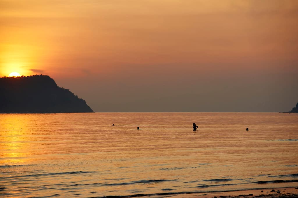
The mountains announce themselves from kilometers away: sharp limestone fins rising vertically from the coastal plain, their faces pocked with caves and draped in jungle. You'll stand ankle-deep in the Gulf, warm water lapping, and count the peaks marching north—some needle-thin, others broad and whale-backed, all of them older than any human use of this coast. The beach runs wide and clean, backed by casuarinas and the occasional fishing shack, empty except for the long-tail boats pulled above the tide line.
This is the national park's quiet edge, the beach access most visitors skip in their rush to the cave temples inland. You'll have the sand largely to yourself, sharing it with villagers who've fished these waters for generations and the occasional Thai family on a weekend escape. The swimming is gentle—soft sand underfoot, gradual deepening, water that stays bathwater-warm even in December. Behind you, the mountains shift color with the light: grey-green at dawn, bone-white at noon, purple-shadowed by late afternoon.
Palm trees framing a sunset shore
Tropical island lagoon from above
Limestone backdrop, Gulf foreground
Warm, gentle, scenic swimming
Trails, caves, wetlands nearby
Prime Visitation
Best Weather|Less Crowds
Where it is
Sam Roi Yot Beach
Sam Roi Yot, Prachuap Khiri Khan, Thailand
12.212400°, 100.006200°
Weather
Loading…
Swell
—
Temp
Warm · Restorative
UV Index
Moderate
Wind
—
Tidal State
Last known
Max Sunlight
—
Ideal Shade
—
Jan - Dec (Peak)
May - Nov (Off-season)
Best Weather|Less Crowds
Select a category to load nearby places.
Unlock restaurants, luxury stays and curated maritime experiences within 2km
Sam Roi Yot Beach is generally safe for swimming during the dry season from November to April when Gulf waters are calm and conditions are favorable. The beach has a gentle gradient suitable for most swimmers and families. During the monsoon season (May to October), waves can become stronger and currents more unpredictable, requiring greater caution. Lifeguard services are not consistently available, so swimmers should assess conditions independently and supervise children closely. The beach is relatively undeveloped, meaning fewer people and less infrastructure. Always check weather conditions before swimming and avoid the water during storms or when seas appear rough.
The best time to visit Sam Roi Yot Beach is during the dry season from November through February, when the weather is sunny, humidity is lower, and the limestone peaks are clearly visible against blue skies. This period offers ideal conditions for beach activities and exploring nearby Khao Sam Roi Yot National Park. March and April bring hotter temperatures but remain good for visiting. The rainy season lasts from May to October, with the heaviest rainfall in September and October, though the dramatic scenery can be beautiful even with clouds. Weekdays are quieter, and early mornings offer the best light for photography.
Sam Roi Yot Beach is located approximately 60 kilometers south of Hua Hin in Prachuap Khiri Khan Province. By car, take Highway 4 (Phetkasem Road) south and follow signs toward Sam Roi Yot district and the national park area, then turn toward the coast. The drive from Hua Hin takes about one hour. Buses traveling between Hua Hin and Prachuap Khiri Khan can drop you in Sam Roi Yot town, from where you'll need local transport (taxi or motorbike taxi) to reach the beach. Renting a car or motorbike provides the most flexibility for exploring the area and nearby national park attractions.
Sam Roi Yot Beach has limited accommodation directly on the beach, with a few small resorts and guesthouses offering basic to mid-range rooms, often with views of the dramatic limestone peaks. The area is relatively undeveloped compared to Hua Hin or Pranburi. Additional accommodation options are available in Sam Roi Yot town and near the national park headquarters. Dining options include small beachfront restaurants and local eateries serving fresh seafood and traditional Thai cuisine at reasonable prices. For more extensive facilities and dining variety, Pranburi (about 20 kilometers north) or Hua Hin offer wider selections while still allowing day trips to the beach.
Sam Roi Yot Beach is distinguished by its dramatic natural setting, backed by the towering limestone karst peaks of Khao Sam Roi Yot National Park, creating one of Thailand's most photogenic coastal landscapes. The name means "Mountain of Three Hundred Peaks," and these formations provide a stunning backdrop rarely seen at other Gulf beaches. The area remains relatively undeveloped, offering an authentic, peaceful atmosphere away from mass tourism. The proximity to the national park means easy access to caves, hiking trails, wetlands, and wildlife viewing. This combination of beautiful beach, dramatic geology, and nature opportunities makes it unique and particularly appealing for photographers and nature enthusiasts.
Photos