Counting the waves…
Counting the waves…
A refined fusion of water purity, environmental stability, and communal vibrancy for Butler Island Shoreline Beach.
View MethodologyAnalyzed via live sensors and environmental data.
Wave height, wind, and atmospheric stability.
Live footfall and crowd balance metrics.
Community reviews and curated sentiment.
“You'll smell the pluff mud before you see the water—that mineral-rich scent rising from marshlands older than the nation itself. Butler Island's shoreline unfolds along the Altamaha Delta, a place where egrets stalk…”
Limited recent visitor reports — live OBI telemetry is your best guide for current conditions.
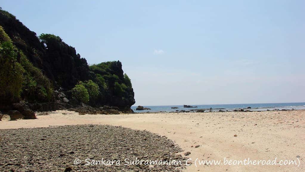
The shoreline at Butler Island doesn't announce itself. You park near the crumbling rice plantation dikes—relics from the 1800s when enslaved workers engineered these tidal fields—and walk paths hemmed by live oaks dripping Spanish moss. The beach, such as it is, appears as a ribbon of sand and shell hash bordering slow-moving channels where dolphins surface without fanfare. Bring binoculars: this is the Atlantic Flyway, and during migration windows you'll spot wood storks, roseate spoonbills, and painted buntings threading through the wetlands.
The water here runs brackish and tea-colored, stained by tannins from upstream cypress swamps. You won't find beach chairs or umbrellas. Instead, you'll discover fiddler crabs scuttling across mudbanks at low tide, their choreography oddly mesmerizing. Kayakers glide past, en route to the labyrinth of tidal creeks that lace the delta. The shoreline shifts with each tide cycle, revealing oyster beds that rasp underfoot and sandbars that vanish by afternoon.
Launch at high tide only
Golden hour brings hunting egrets
Antebellum engineering still visible today
Where it is
Butler Island Shoreline Beach
Darien, Georgia, USA
31.389600°, -81.370200°
Weather
Loading…
Swell
—
Temp
Warm · Restorative
UV Index
Moderate
Wind
—
Tidal State
Last known
Max Sunlight
—
Ideal Shade
—
May - Sep (Peak)
Jan - Dec (Off-season)
Historical data suggests peak visibility and stable sea temperatures occur during the prime visitation window.
Select a category to load nearby places.
Unlock restaurants, luxury stays and curated maritime experiences within 2km
Butler Island Shoreline Beach is primarily a scenic viewing area rather than a traditional swimming beach. The shoreline borders tidal marshlands and the Altamaha River estuary, where currents can be strong and unpredictable. The water is typically murky due to river sediment and marsh runoff. There are no lifeguards, designated swimming areas, or safety facilities. Visitors should exercise caution near the water's edge and supervise children closely. The beach is better suited for beachcombing, wildlife watching, and photography than swimming activities.
Butler Island Shoreline Beach can be visited year-round, with each season offering different experiences. Spring and fall provide comfortable temperatures (60-80°F) and excellent birdwatching opportunities during migration periods. Summer brings heat and humidity but vibrant marsh grasses. Winter offers cooler, quieter conditions ideal for photography and solitude. Early morning or late afternoon visits provide the best lighting and wildlife activity. Check tide schedules, as low tide reveals more shoreline for exploration. Mosquitoes can be abundant in warmer months, so bring insect repellent.
Butler Island Shoreline Beach is located along US Highway 17 between Darien and Brunswick, Georgia. Access is somewhat limited as this is primarily a roadside viewing area rather than a developed beach park. Visitors typically pull off along the highway shoulder near the Butler Island historical marker, though dedicated parking is minimal. Exercise caution when parking along the busy highway. The location is approximately 60 miles south of Savannah and can be combined with visits to nearby historic sites and wildlife refuges in the Darien area.
Butler Island Shoreline Beach has no on-site facilities, restrooms, or amenities. The nearby town of Darien, approximately 5 miles away, offers several seafood restaurants, cafes, and basic services. Popular dining options include local shrimp and oyster establishments. For lodging, Darien has a few small inns and motels, while Brunswick and Jekyll Island (15-20 miles south) provide more extensive accommodation options. Visitors should bring water, snacks, and any necessary supplies. The nearest gas stations and convenience stores are in Darien along Highway 17.
Butler Island holds significant historical importance as the site of Pierce Butler's rice plantation, one of the largest in antebamah River delta during the antebellum period. The island's history is notably documented in Frances Anne Kemble's journal, which provided a rare firsthand account of slavery conditions. Today, interpretive markers along the roadside explain this history. The surrounding landscape still shows remnants of the old rice field dike system. Visitors interested in Lowcountry history and Gullah Geechee heritage will find this a meaningful, though sobering, destination.