Counting the waves…
Counting the waves…
A refined fusion of water purity, environmental stability, and communal vibrancy for Lighthouse Beach (Coos Bay).
View MethodologyAnalyzed via live sensors and environmental data.
Wave height, wind, and atmospheric stability.
Live footfall and crowd balance metrics.
Community reviews and curated sentiment.
“You'll hear the barking before you see them: dozens of harbor seals hauled out on offshore rocks, their voices mingling with the crash of Pacific swells. This little-known stretch wraps around Coos Bay's rugged southern…”
Limited recent visitor reports — live OBI telemetry is your best guide for current conditions.

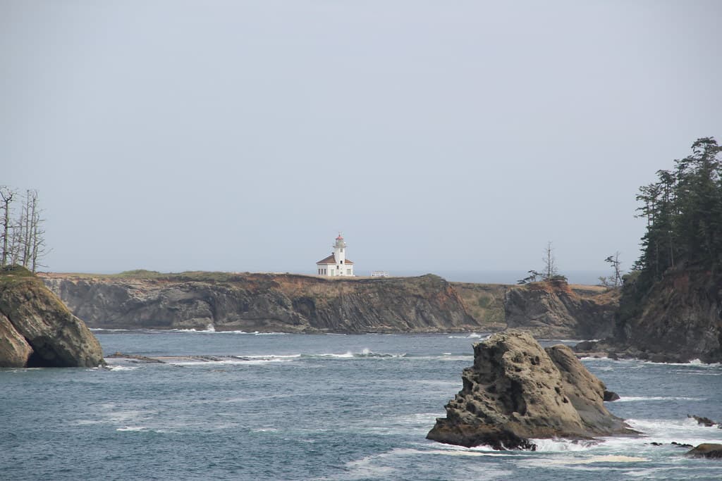
The trail from the parking area drops you onto a beach that feels like Oregon's coastal secret—no boardwalks, no kiosks selling saltwater taffy, just weathered Sitka spruce leaning inland from decades of ocean wind. You walk on sand the color of wet cement, dodging bull kelp and razor clam shells, while Cape Arago Lighthouse rises from Shell Island a few hundred yards offshore. Built in 1934, the octagonal tower is off-limits to visitors, but its white column and brick keeper's quarters make a striking focal point against the basalt cliffs.
Harbor seals own the rocks between you and the lighthouse. During pupping season—May through September—mothers nurse their young on the island's lower shelves, and their guttural calls carry across the water. Steller sea lions sometimes muscle in, their bulk making the seals look like puppies. Bring binoculars; the Marine Mammal Protection Act keeps humans at a distance, but you'll see whiskers and flippers in fine detail.
Long-tail boats moored in clear water
Crystal lagoon with rocky outcrop
Shoot from driftwood at low tide
Bring binoculars for Shell Island
Lean logs block coastal wind
Where it is
Lighthouse Beach (Coos Bay)
Coos Bay, Oregon, USA
43.324500°, -124.396200°
Weather
Loading…
Swell
—
Temp
Warm · Restorative
UV Index
Moderate
Wind
—
Tidal State
Last known
Max Sunlight
—
Ideal Shade
—
May - Sep (Peak)
Jan - Dec (Off-season)
Historical data suggests peak visibility and stable sea temperatures occur during the prime visitation window.
Select a category to load nearby places.
Unlock restaurants, luxury stays and curated maritime experiences within 2km
Swimming at Lighthouse Beach is generally not recommended due to cold water temperatures year-round, strong currents, and unpredictable waves typical of Oregon's coast. The beach is better suited for beachcombing, tide pooling, and scenic walks. If you do wade in the water, stay close to shore and never turn your back on the ocean, as sneaker waves can occur without warning. Always supervise children closely near the waterline and check local conditions before visiting.
Lighthouse Beach is accessible year-round, with each season offering distinct experiences. Summer (June-September) provides the most stable weather and calmer seas, ideal for exploring tide pools and scenic photography. Spring and fall offer dramatic storm-watching opportunities and fewer crowds. Winter can be stormy but spectacular for witnessing powerful waves. Mornings typically offer clearer skies and better lighting for photographing the lighthouse. Low tide is best for exploring the rocky shoreline and discovering marine life.
Lighthouse Beach is located at Cape Arago, about 12 miles southwest of downtown Coos Bay. Follow Cape Arago Highway through Charleston, continuing past Sunset Bay and Shore Acres State Park. Free parking is available at the Cape Arago State Park lot at the highway's end. From the parking area, a short trail leads down to the beach. The road is paved and well-maintained, though it can be winding in sections. No special vehicle is required to access the area.
The nearby community of Charleston, about 6 miles from Lighthouse Beach, offers several seafood restaurants, cafes, and a small grocery store. Popular dining options include fresh seafood at local establishments along the Charleston Marina. For lodging, you'll find motels and vacation rentals in Charleston and more extensive hotel options in Coos Bay itself. Shore Acres State Park, just minutes away, has no facilities, so plan accordingly. Pack water and snacks for your beach visit, as no amenities exist at the beach itself.
The Cape Arago Lighthouse, visible from the beach, sits on a small island connected to Chief's Island and is not open to the public. It remains an active aid to navigation managed by the Coast Guard. You can view the lighthouse from several vantage points along the cape, including the beach and nearby viewpoints along Cape Arago Highway. The best views for photography are typically from Shore Acres State Park observation areas or the beach itself during low tide, when you can walk closer to the offshore rocks.
Photos