Counting the waves…
Counting the waves…
A refined fusion of water purity, environmental stability, and communal vibrancy for Playa Boca de Manare.
View MethodologyAnalyzed via live sensors and environmental data.
Wave height, wind, and atmospheric stability.
Live footfall and crowd balance metrics.
Community reviews and curated sentiment.
“The Manare River empties here in a silty delta that stains the ocean amber for fifty meters offshore. Stand at the river mouth and you're between worlds: freshwater fish to your left, reef species to your right, and a…”
Limited recent visitor reports — live OBI telemetry is your best guide for current conditions.
You arrive by panga from Mochima village, the boat nosing through shallows where the river's fresh water rides atop the denser seawater, creating swirls visible from above. The beach curves in a gentle arc, backed by mangroves whose roots trap plastic bottles and driftwood in equal measure. Children from the handful of houses upstream play in the river current while their parents mend nets in the shade of almond trees.
The sand is gray-brown, volcanic in origin, nothing like the white coral beaches of the offshore cays. It squeaks underfoot when dry and holds heat like a griddle by afternoon. Where fresh water meets salt, tiny fish swirl in clouds—juveniles using the brackish zone as a nursery before migrating to reef or river. Bring a mask and you'll see both ecosystems colliding: freshwater tetras darting alongside damselfish, neither quite comfortable in the mixed salinity.
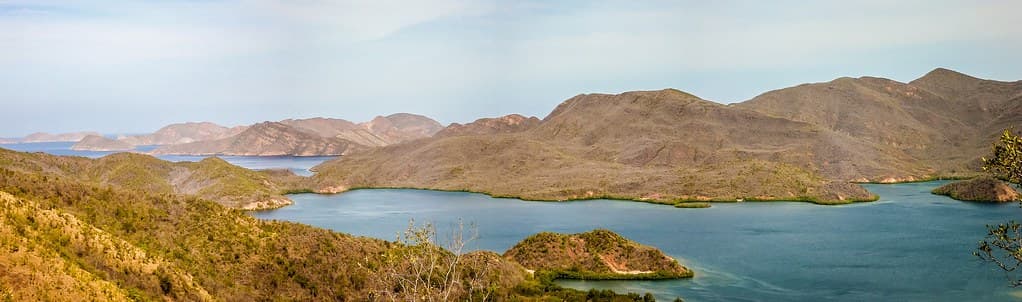
Tropical island lagoon from above
River-ocean mixing zone
Color-banded water photography
Mangrove channel paddling
Prime Visitation
Less Crowds|Budget Travel
Where it is
Playa Boca de Manare
Mochima, Sucre, Venezuela
10.273500°, -64.452900°
Weather
Loading…
Swell
—
Temp
Warm · Restorative
UV Index
Moderate
Wind
—
Tidal State
Last known
Max Sunlight
—
Ideal Shade
—
Jan - Dec (Peak)
May - Nov (Off-season)
Less Crowds|Budget Travel
Select a category to load nearby places.
Unlock restaurants, luxury stays and curated maritime experiences within 2km
Playa Boca de Manare is generally considered family-friendly, with sandy shores that are suitable for children to play on. As a beach at a river mouth, water conditions can vary - the mixing of river and sea water sometimes creates calmer areas suitable for young swimmers. However, there are no lifeguards, so adult supervision is essential. The currents where river meets ocean can occasionally be stronger, so keep children in shallower areas. The sandy bottom and gradual slope in most areas make it easier for families than rocky beaches.
Visit Playa Boca de Manare during Venezuela's dry season from December to April for the best weather and calmest seas. This period also offers budget travel advantages with more negotiable boat rates, especially on weekdays. The beach remains relatively uncrowded year-round due to its hidden location requiring boat access. Late afternoon visits are particularly rewarding for sunset photography. Avoid the rainy season (May-November) when river discharge can affect water clarity and sea conditions may be rougher, making boat access more challenging.
Access to Playa Boca de Manare requires boat transportation from Mochima town or other nearby coastal departure points in Sucre. Local fishermen and tour operators provide boat services to this and other beaches in the Mochima National Park area. Travel time is typically 20-40 minutes depending on your departure point and sea conditions. Arrange transportation in advance or at the Mochima pier, agreeing on price and return time before departure. Some visitors combine this beach with others in a day-trip island-hopping tour for better value.
Playa Boca de Manare has no on-site facilities, restaurants, or lodging due to its remote, hidden nature. Visitors must bring their own food, beverages, and supplies for the day. The closest accommodations are in Mochima town, offering budget posadas and guesthouses with basic amenities. Local restaurants in Mochima serve fresh seafood and Venezuelan cuisine. Pack a well-stocked cooler with lunch, snacks, and drinking water, and remember to carry out all waste. Some boat tours include meal provisions as part of package deals.
Playa Boca de Manare is located at the mouth (boca) of a river where it meets the Caribbean Sea, creating a unique ecological transition zone. This positioning creates distinctive water conditions where freshwater mixes with saltwater, sometimes producing interesting color gradients and varied swimming experiences. The river mouth setting often means lusher vegetation nearby and potential wildlife sightings. The mixing of waters can create nutrient-rich areas attracting fish, making it interesting for snorkeling. This geographical feature distinguishes it from purely coastal or purely cove beaches in the region.
Photos