Counting the waves…
Counting the waves…
A refined fusion of water purity, environmental stability, and communal vibrancy for Honeymoon Bay.
View MethodologyAnalyzed via live sensors and environmental data.
Wave height, wind, and atmospheric stability.
Live footfall and crowd balance metrics.
Community reviews and curated sentiment.
“You'll smell the salt spray before the launch beaches you on blonde sand hemmed by she-oak forest. The only footprints belong to goannas and the occasional ranger. Honeymoon Bay hides beneath Cape Moreton's century-old…”
Limited recent visitor reports — live OBI telemetry is your best guide for current conditions.
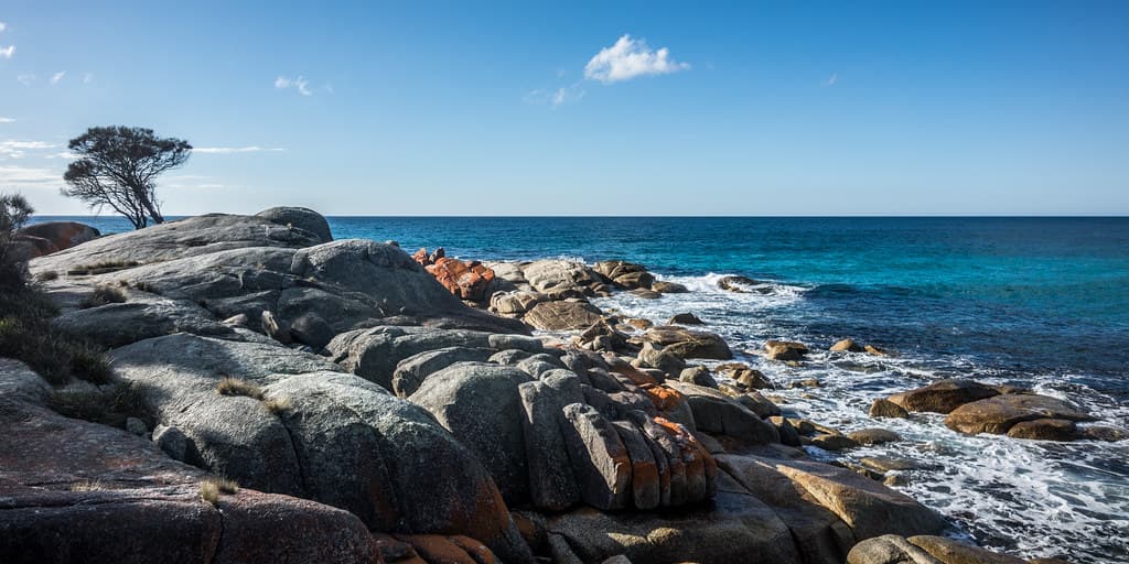
The tender cuts its engine fifty meters offshore, and you wade through bathwater shallows onto sand so fine it squeaks underfoot. Honeymoon Bay arcs in a tight crescent beneath Cape Moreton's basalt headland, sheltered from the Coral Sea's prevailing swells by reef fingers that turn incoming waves into frothy riffles. She-oaks whisper behind the high-tide line, their needles carpeting the narrow strip where wallabies bound at dusk. No roads reach this cove—just a network of sand tracks that dead-end kilometers south, making every visitor a passenger, every arrival a small act of commitment.
The lighthouse keeper's cottage still crowns the cape above, its whitewashed walls visible through breaks in the coastal scrub. Early mornings, you might spot researchers tagging loggerheads that nest here November through February, their flippers carving temporary highways across virgin sand. The snorkeling skirts rocky outcrops thick with sergeant majors and wrasse; bring booties, because the entry is all chunky volcanic rubble disguised by knee-deep water.
Volcanic boulders shelter tropical fish
Cape Moreton's 1857 beacon above
Reef-protected calm morning water
Where it is
Honeymoon Bay
Cape Moreton, Queensland, Australia
-27.035000°, 153.458000°
Weather
Loading…
Swell
—
Temp
Warm · Restorative
UV Index
Moderate
Wind
—
Tidal State
Last known
Max Sunlight
—
Ideal Shade
—
Jan - Dec (Peak)
Mar - Nov (Off-season)
Historical data suggests peak visibility and stable sea temperatures occur during the prime visitation window.
Select a category to load nearby places.
Unlock restaurants, luxury stays and curated maritime experiences within 2km
Honeymoon Bay is generally considered safe for swimming due to its protected cove location on Moreton Island's western side, which offers calmer waters than the ocean-facing beaches. The bay's sheltered position provides natural protection from strong currents and large waves. However, always check local conditions before entering the water, be aware of marine life including stingrays in shallow areas, and swim within your ability level. There are no lifeguard patrols at this remote location, so exercise caution and never swim alone.
Honeymoon Bay can be enjoyed year-round, though each season offers different advantages. Winter months (June-August) provide mild, pleasant weather with temperatures around 20-25°C, ideal for comfortable beach activities. Summer (December-February) brings warmer water temperatures perfect for swimming, though it can be humid with occasional afternoon storms. Spring and autumn offer excellent conditions with moderate temperatures and fewer crowds. Water visibility is typically best during winter months. Weekdays generally see fewer visitors than weekends regardless of season.
Honeymoon Bay is only accessible by boat or 4WD vehicle via Moreton Island, as there's no bridge to the island. Most visitors take the vehicle ferry from Tangalooma or Moreton Island Barge Service from the mainland, then drive north on beach tracks requiring a 4WD with appropriate permits. The journey involves beach and inland track driving. Alternatively, some tour operators offer boat trips. There's no formal parking lot—vehicles park on designated beach areas. A Queensland Parks permit is required for vehicle access to Moreton Island.
Honeymoon Bay has no commercial facilities, restaurants, or shops—it's a completely undeveloped, remote beach. Visitors must bring all food, water, and supplies. The nearest accommodation options are camping areas elsewhere on Moreton Island, including designated campgrounds that require advance booking through Queensland Parks. Basic facilities like toilets may be found at some island camping areas, but not directly at Honeymoon Bay. The nearest resort facilities are at Tangalooma, several kilometres south. Come fully self-sufficient with camping gear, provisions, and emergency supplies.
Yes, Honeymoon Bay is located near Cape Moreton, where Australia's oldest lighthouse still operates. While views from the bay itself may be limited depending on your exact position, the historic Cape Moreton Lighthouse is nearby and accessible via walking tracks. Built in 1857, the lighthouse offers panoramic views of the surrounding area. Many visitors combine a trip to Honeymoon Bay with a visit to the lighthouse. The walk to the lighthouse provides spectacular coastal scenery and whale-watching opportunities during migration season (June-November).