Counting the waves…
Counting the waves…
A refined fusion of water purity, environmental stability, and communal vibrancy for Tres Reyes Islands Beach.
View MethodologyAnalyzed via live sensors and environmental data.
Wave height, wind, and atmospheric stability.
Live footfall and crowd balance metrics.
Community reviews and curated sentiment.
“You'll time your arrival with the tide chart, because these islands reveal their best angles when the water retreats and exposes causeways of packed sand. Each karst formation hosts its own microhabitat: roosting…”
Limited recent visitor reports — live OBI telemetry is your best guide for current conditions.
The bangka engine cuts out a hundred meters from shore, and suddenly you hear what the motor obscured: wind scraping through limestone crevices, the hiss of wavelets on sand, the conversational squawk of reef egrets. The Tres Reyes—Spanish for "Three Kings"—rise in a line from southwest to northeast, their cliffs honeycombed with cavities carved by millennia of rain and spray. At high tide they appear as separate entities, but you've timed this right: the water's dropping, and the sandbars are already emerging like pale tongues between the islands.
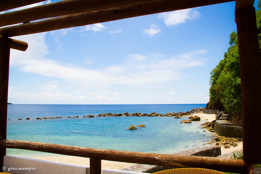
You wade ashore on the southernmost island, feet sinking into sand that's almost white, ground from coral and shell over geological time. The beach wraps halfway around the base before surrendering to vertical rock face. Hermit crabs scatter at your approach, dragging borrowed shells that click against volcanic pebbles mixed with the coral sand. The island's interior is barely explorable—too steep, too dense with salt-tolerant scrub—but the circumference walk reveals tide pools trapped in limestone basins, each one a miniature ecosystem of urchins, anemones, and thumb-sized fish in neon colors.
 Credit: Unsplash
a group of boats sitting on top of a sandy beach
 Credit: Unsplash
white boat during dayhtime
Walk between islands at low tide
Walls plunge to thirty meters
Limestone erosion patterns
Prime Visitation
Best Weather
Where it is
Tres Reyes Islands Beach
Gasan, Marinduque, Philippines
13.297000°, 121.858000°
Weather
Loading…
Swell
—
Temp
Warm · Restorative
UV Index
Moderate
Wind
—
Tidal State
Last known
Max Sunlight
—
Ideal Shade
—
Jan - Dec (Peak)
May - Nov (Off-season)
Historical data suggests peak visibility and stable sea temperatures occur during the prime visitation window.
Near Tres Reyes Islands Beach
Explore dining, stays, nightlife, and activities near Tres Reyes Islands Beach in Gasan, Philippines. Every listing below is a real place linked to this beach — open a card for reviews, maps, and booking options.
Food, cafés, and dining close to Tres Reyes Islands Beach — curated from places linked to this beach.
Stays and lodging options near Tres Reyes Islands Beach for your beach trip.
Select a category to load nearby places.
Unlock restaurants, luxury stays and curated maritime experiences within 2km
Swimming safety at Tres Reyes Islands varies by specific location within the island group and weather conditions. During calm weather in the dry season, swimming is generally safe in protected coves and beaches. However, as these are offshore islands, currents can be present between islands and in open water areas. Always assess local conditions before swimming and stay close to shore if you're unsure. No lifeguards are stationed here, so swim responsibly. Ask your boatman about the safest swimming spots, as they know local currents and conditions best.
The optimal time to visit Tres Reyes Islands is during the dry season from November through May, particularly December to April when weather is most stable for island hopping. Calm seas during these months make boat travel safer and more comfortable. The clearer skies also enhance the islands' natural beauty and are better for photography and snorkeling. Weekdays typically see fewer visitors than weekends. Avoid the southwest monsoon season (June to October) when rough seas can make boat access difficult and weather conditions unpredictable for island activities.
Tres Reyes Islands are accessed by boat from Gasan, Marinduque. First, reach Marinduque via ferry from Lucena or Dalahican ports on mainland Luzon, or fly to a nearby airport. From Gasan town, hire a local bangka or arrange an island-hopping tour with local operators. The boat trip duration depends on which island in the group you're visiting and sea conditions. It's best to arrange boat transport through your accommodation or local tourism offices in Gasan. Always confirm return trip arrangements and ensure you hire experienced boatmen familiar with the area.
Tres Reyes Islands have minimal to no permanent food and accommodation infrastructure as they are primarily uninhabited natural islands. Visitors should treat this as a day-trip destination and bring all necessary supplies including food, water, sunscreen, and other essentials from Gasan town. Pack a picnic lunch and plenty of drinking water for your island-hopping adventure. For overnight stays, you'll need to book accommodation in Gasan or nearby towns in Marinduque and visit the islands as day excursions. Some tour operators may provide packed meals as part of island-hopping packages.
Tres Reyes Islands' uniqueness lies in being a small archipelago offering multiple island-hopping experiences in one area. The island group configuration provides diverse beach environments, from sandy shores to rocky outcrops, all within a relatively compact area. This makes it ideal for explorers who want variety in a single trip. Each island may offer different snorkeling opportunities and coastal scenery. The islands' collective charm and the adventure of hopping between them creates a memorable experience distinct from single-beach destinations. The relative isolation ensures pristine conditions and uncrowded beaches.
Photos