Counting the waves…
Counting the waves…
A refined fusion of water purity, environmental stability, and communal vibrancy for Godzilla Rock South Beach.
View MethodologyAnalyzed via live sensors and environmental data.
Wave height, wind, and atmospheric stability.
Live footfall and crowd balance metrics.
Community reviews and curated sentiment.
“You'll walk a narrow strip of volcanic sand in the shadow of Godzilla Rock—a 15-meter tuff formation that has guarded this coast for millennia. The beach itself rarely sees more than a handful of locals casting lines…”
Limited recent visitor reports — live OBI telemetry is your best guide for current conditions.
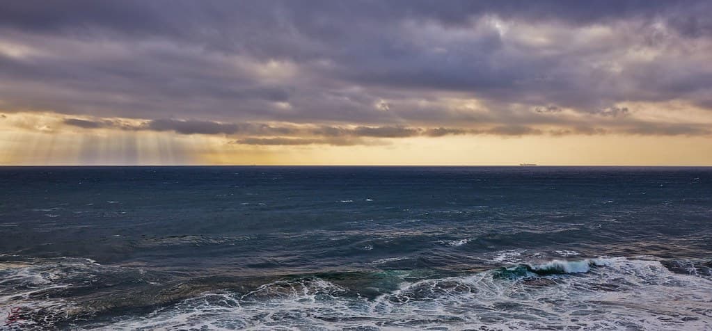
The basalt shore curves south from the famous Godzilla Rock formation, a stretch of dark sand and water-smoothed stones that most visitors overlook in their rush to photograph the namesake monolith. You'll notice the difference in texture underfoot—fine volcanic grit mixed with larger pebbles that rattle when the tide pulls back. Winter winds off the Sea of Japan shape driftwood into skeletal sculptures, while summer brings just enough warmth to make wading tolerable, though few attempt it given the persistent chill of these northern waters.
Local anglers know the rocky outcrops at either end hold greenling and flounder, and you'll often see them perched on boulders at dawn, thermoses steaming in the salt air. The beach functions less as a sunbathing destination than as a meditative access point to Oga's volcanic coastline—a place where you come to watch weather systems roll in from Siberia and feel appropriately small. Tide pools form in the pitted lava shelves, harboring purple sea stars and the occasional octopus.
Credit: PixabayTide Pool Macro
Sea stars in volcanic crevices
Basalt shelves toward cape
Sandfish at roadside stalls
Where it is
Godzilla Rock South Beach
Oga, Akita, Japan
39.958200°, 139.723100°
Weather
Loading…
Swell
—
Temp
Warm · Restorative
UV Index
Moderate
Wind
—
Tidal State
Last known
Max Sunlight
—
Ideal Shade
—
May - Sep (Peak)
Jan - Dec (Off-season)
Historical data suggests peak visibility and stable sea temperatures occur during the prime visitation window.
Near Godzilla Rock South Beach
Explore dining, stays, nightlife, and activities near Godzilla Rock South Beach in Oga, Japan. Every listing below is a real place linked to this beach — open a card for reviews, maps, and booking options.
Food, cafés, and dining close to Godzilla Rock South Beach — curated from places linked to this beach.
Select a category to load nearby places.
Unlock restaurants, luxury stays and curated maritime experiences within 2km
Swimming conditions at this beach vary with weather and season. The Sea of Japan can experience strong currents and waves, particularly during autumn and winter. The beach lacks lifeguards and formal safety infrastructure, so swimming requires caution and personal assessment of conditions. The rocky shoreline and proximity to Godzilla Rock create uneven underwater terrain. Most visitors come for photography and sightseeing rather than swimming. Check local weather forecasts before visiting, avoid rough sea days, and never swim alone in this remote location.
While accessible year-round, late spring through early autumn (May-October) offers the most pleasant weather for visiting. Summer provides warm temperatures ideal for beach exploration, though it can be busy. Sunset visits are particularly popular for dramatic photography against the rock formation. Winter visits are possible but expect cold winds from the Sea of Japan and potentially rough seas. Early morning hours offer quieter experiences with softer lighting. The rock formation itself is photogenic in all seasons, though weather conditions significantly affect accessibility and comfort.
The beach is located on the Oga Peninsula, accessible primarily by car. From central Oga, follow coastal roads toward the Namahage Museum area, then continue south along the shoreline. Limited parking is available near the beach access points, though facilities are basic and unmarked in this rural area. Public transportation options are extremely limited, making rental cars the most practical choice. The drive from Akita city takes approximately 90 minutes. Roads can be narrow and winding along the coast, requiring careful driving, especially in poor weather.
This is a remote, undeveloped beach area with minimal nearby amenities. The closest restaurants and convenience stores are in central Oga town, several kilometers away. Traditional ryokan and small hotels can be found in Oga's main areas and near the Namahage Museum, but not directly at the beach. Visitors should bring their own food, water, and supplies. The nearest significant lodging and dining options are in Oga city or back toward Akita. Plan accordingly as this is a day-trip destination without beachside facilities or services.
The rock formation resembles Godzilla's distinctive profile when viewed from the beach, particularly from certain angles at sunset. Local tourism associations promoted this resemblance, making it a quirky photo spot for Japanese tourists and Godzilla fans. The silhouette effect is most pronounced during golden hour when backlighting emphasizes the shape. The formation is visible from the adjacent shoreline, making photography straightforward. While not a major tourist attraction internationally, it has become a fun stop for those exploring Oga Peninsula's rugged coastline and seeking unusual photo opportunities.
Photos